


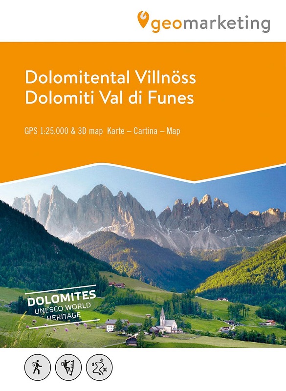
3D-Wanderkarte Villnöß und Umgebung
3D Panoramabild mit eingezeichnetem Wegenetz und Touren
Die Geomarketing-Wanderkarten sind digital erstellte GPS-taugliche Outdoorkarten in den optimalen Maßstäben von 1:25.000 bis 1:50.000. Geomarketing-Wanderkarten bestechen durch ihre klare Darstellung, die leichte Lesbarkeit, der Fülle an touristischen Informationen sowie durch Tourenvorschläge zu allen Outdoor-Themen wie Wandern, Klettern, Biken, Radfahren etc. Durch die enge Zusammenarbeit mit lokalen Insidern wie Bergführern, Alpinschulen, Tourismusvereinen und Hoteliers sowie durch ständig überarbeitete und aktualisierte Auflagen ist die Geomarketing-Wanderkarte die aktuellste Wanderkarte von Südtirolern für Südtirol. Die Kombination von detaillierten topografischen Karten einerseits und plastischen 3D-Panoramen andererseits garantiert bestmögliche Informationen für den Nutzer.
Cartina escursionistica 3D Val di Funes e dintorni
Immagine panoramica 3D con rete di sentieri disegnati e percorsi
Le mappe escursionistiche di geomarketing sono mappe esterne compatibili con GPS create digitalmente nella scala ottimale da 1:25.000 a 1:50.000. Le carte escursionistiche geomarketing convincono per la loro presentazione chiara, facile leggibilità, ricchezza di informazioni turistiche e suggerimenti di tour su tutti i temi outdoor come escursionismo, arrampicata, mountain bike, ciclismo, ecc. Grazie alla stretta collaborazione con addetti ai lavori locali come guide alpine, scuole alpine , associazioni turistiche e albergatori e edizioni costantemente riviste e aggiornate fanno della cartina escursionistica geomarketing la carta escursionistica dell'Alto Adige più aggiornata per gli altoatesini. La combinazione di mappe topografiche dettagliate da un lato e panorami 3D tridimensionali dall'altro garantisce le migliori informazioni possibili per l'utente.
Lingua: Deutsch, English, Italiano