


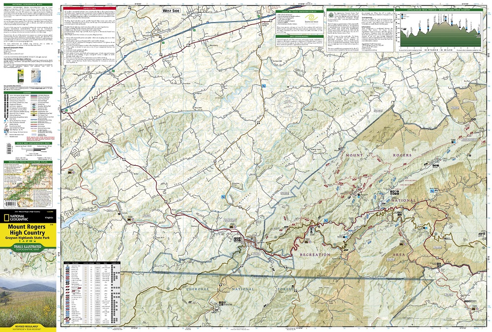
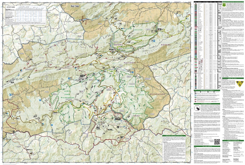
Let National Geographic guide you to the highest areas in southwestern Virginia with our Trails Illustrated map of Mount Rogers High Country and Grayson Highlands State Park. Expertly researched and created in partnership with the U.S. Forest Service, Virginia State Parks and others, the unparalleled detail of the map will lead you around this scenic and recreational area. A chart with each trail's location, mileage, difficulty rating and designated use will help you choose a suitable route, whether traveling by bike, motorcycle, horseback or on foot. A special trail profile of the Appalachian Trail is also including, showing elevations, distances and key points of interest along it's 60 mile section within the high country. The Virginia Highlands Horse Trail and Virginia Creeper Trail are also both highlighted. All trails have mileage markers between intersections and are color-coded according to their designated usage. The map base includes contour lines, elevations for summits and water features.
Recreational activities are clearly indicated, including: campgrounds, horse camps and backcountry shelters; boat ramps, fishing areas and stocked trout streams; wildlife viewing areas and scenic viewpoints and much more. Mount Rogers Scenic Byway and Virginia's scenic byways are noted on the map for those interested in exploring the area by car. Among the key points of interest on the map are the Lewis Fork, Little Wilson Creek, and the Raccoon Branch Wildernesses, Beartree Recreation Area and Iron Mountains. The map also includes useful background information about the area, wilderness rules and regulations, safety tips and contact information.
Other features found on this map include: Cherokee National Forest, Iron Mountains, Jefferson National Forest, Mount Rogers.