en
wishlist
login
mail

contact us

Cartography

Hiking maps, maps and atlases, cartography around the world. Maps of the trails, cartography for cyclotourism and mountain biking

Mountain

Alpine guides, hiking guides, technical manuals for summer and winter mountaineering. Mountain literature and filmography

Sea

Nautical manuals, nautical cartography, books and literature for sailboat and motor

Travels

Travel guides and travel literature for Italy, Europe and the rest of the world

Military

Collection of the best publications (books and DVDs) on the mountain war on the Alps and the rest of Italy and Europe
advanced search ricerca avanzata
back
Mount Rainier National Park  (Washington)
National Geographic | Trails Illustrated Map | USA | impermeabile, antistrappo | 1:55.000

Mount Rainier National Park (Washington)

1:55.000

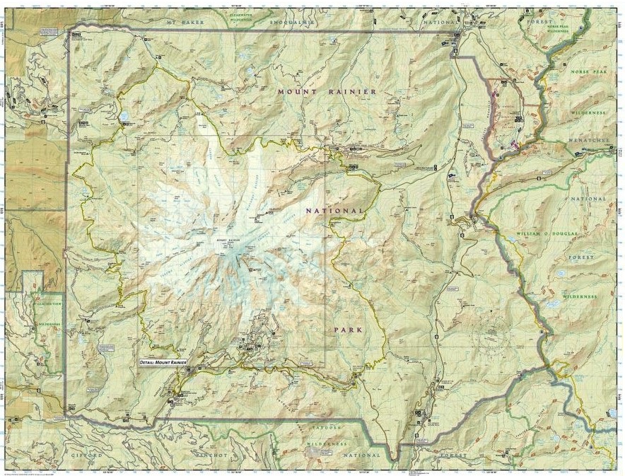
This Trails Illustrated topographic map is the most comprehensive recreational map for Washington's Mount Rainier National Park. Within the park, there is detailed coverage of Mount Rainier and its many glaciers; Eagles Roost, Cataract Valley, Mystic, Emmons Overlook, Indian Bar, Maple Creek, Snow Lake, Paradise River, Jackson and many other camping areas are also included. A detailed inset gives you a close-up view of the peak and trails leading to its glaciers.

add to wish list
€ 12.50
quantity
- 1 +
ship to :: Italia
Corriere espresso € 5.50
availability
available
add to cart