


contact us
We are aware that we left you to deal with other maps of Othrys that are extremely misleading and ideal for getting you lost on the mountain. We do apologize, but ROAD’s cartographers are in limited supply and the list of priorities is quite long. At the same time, ROAD publishers only give the go ahead for printing when 100% of a location has been charted.
The map of Mount Othrys was 95% ready in 2001, but it was not until 2003 that the missing parts were filled in and we published this map that we are extremely proud of, as it covers an important cartographic void and lifts one of the most beautiful and lesser known mountains of Greece out of obscurity.
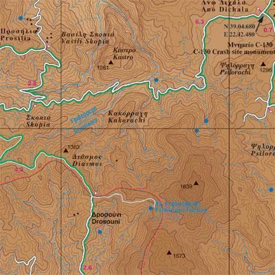
This map has an extremely detailed geophysical background provided by the Hellenic Military Geographic Service, with contour lines at 20 m intervals and a full hydrography charting all rivers, torrents, dry torrents, and springs.
It provides a crystal clear charting of the road network that only ROAD maps provide, including inaccessible secondary unsurfaced roads, with all scenic routes highlighted in green.