en
wishlist
login
mail

contact us

Cartography

Hiking maps, maps and atlases, cartography around the world. Maps of the trails, cartography for cyclotourism and mountain biking

Mountain

Alpine guides, hiking guides, technical manuals for summer and winter mountaineering. Mountain literature and filmography

Sea

Nautical manuals, nautical cartography, books and literature for sailboat and motor

Travels

Travel guides and travel literature for Italy, Europe and the rest of the world

Military

Collection of the best publications (books and DVDs) on the mountain war on the Alps and the rest of Italy and Europe
back
-5%
Italia settentrionale
Touring | Touring - Cartografia Italia 1:400.000 | Milano | 2024 | 12,5 x 23,5 | 1:400.000

Italia settentrionale

1:400.000

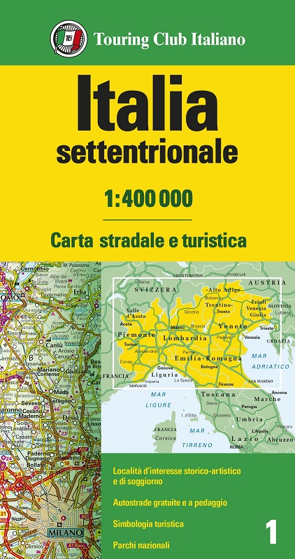
Le Carte d’Italia, suddivise in tre fogli alla scala 1:400 000, forniscono una fotografia precisa e aggiornata dell’intera rete viaria del nostro Paese.
Legenda in 5 lingue: italiano, inglese, tedesco, francese e spagnolo
Città, centri di soggiorno e altre località sono oggetto di un’articolata classificazione sulla base del loro interesse storico-artistico o paesaggistico
La cartografia è impreziosita da una ricca simbologia turistica
La rappresentazione dei rilievi è resa chiaramente attraverso curve di livello e colore
Stampata su carta uso mano, con comoda custodia in pvc.

Lingua: Ita/Ingl/Fra/Ted/Spa


add to wish list
€ 9.41
instead of € 9.90
quantity
- 1 +
ship to :: Italia
Corriere espresso € 5.50
availability
usually shipped within 3/7 days
add to cart