


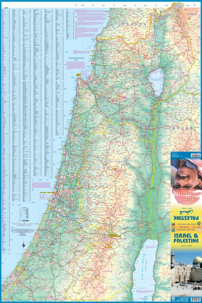
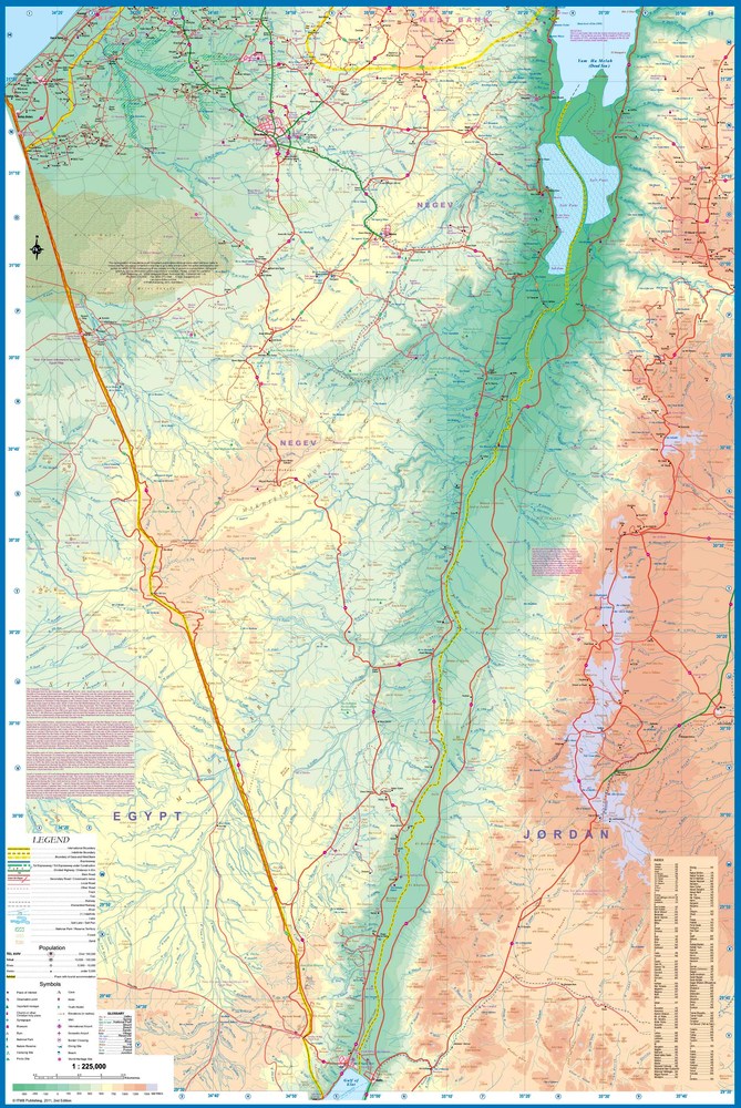
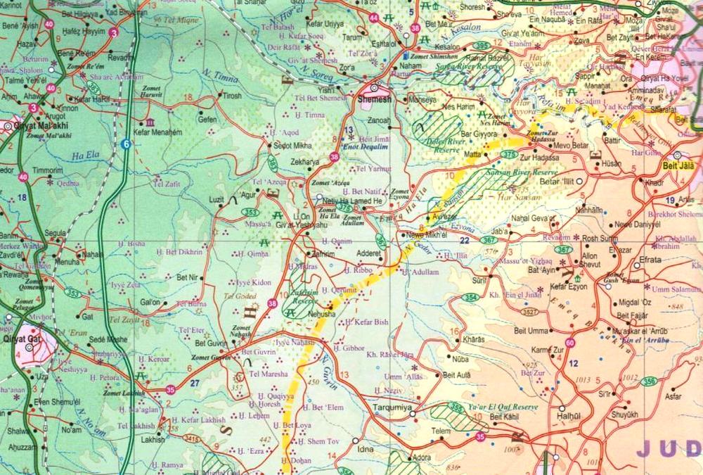
The map includes an enlargement for the environs of Jerusalem, plus a street plan of the city. Bold altitude colouring shows the topography, with graphics for deserts, forests, salt lakes and national parks or protected areas. Road network indicates names of selected crossroads, providing information very useful when driving in Israel. Locations of petrol stations are marked and distances are shown on main routes. Railway lines are included and local airports are marked. Symbols highlight various places of interest, including religious and archaeological sites, beaches and diving sites etc. Also indicated are towns with tourist accommodation and locations of youth hostels. All place names are in Latin alphabet only, some with alternative transliterations. Each side of the map has a separate index.
Please note: boundaries of the West Bank and the Gaza Strip are marked, but without the map showing areas under Palestinian or joint control, or the course of the separation barrier. On the Golan Heights only the current boundary is shown, without the UNDOF zone.