en
wishlist
login
mail

contact us

Cartography

Hiking maps, maps and atlases, cartography around the world. Maps of the trails, cartography for cyclotourism and mountain biking

Mountain

Alpine guides, hiking guides, technical manuals for summer and winter mountaineering. Mountain literature and filmography

Sea

Nautical manuals, nautical cartography, books and literature for sailboat and motor

Travels

Travel guides and travel literature for Italy, Europe and the rest of the world

Military

Collection of the best publications (books and DVDs) on the mountain war on the Alps and the rest of Italy and Europe
back
-20%
Cicladi
Freytag & Berndt | Carte stradali / atlanti | Austria | 13 x 25,5 | 1:150.000

Cicladi

1:150.000

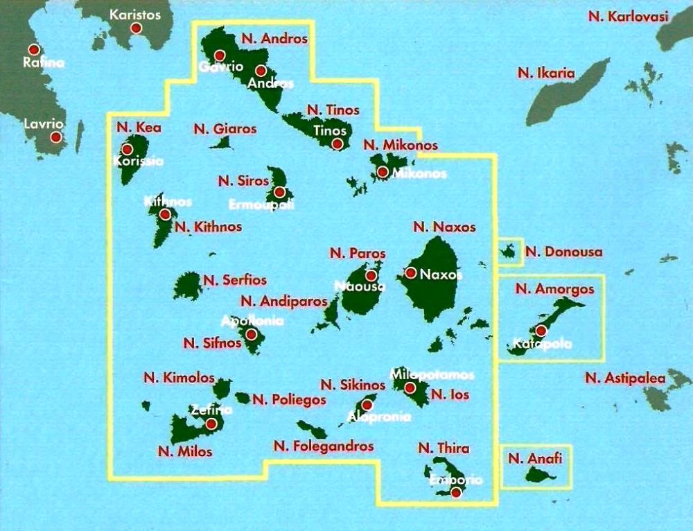
Explore Cyclades Islands with this Freytag&Berndt road map. The best way to plan your trip, prepare your itinerary, and to travel independently in this part of Greece.

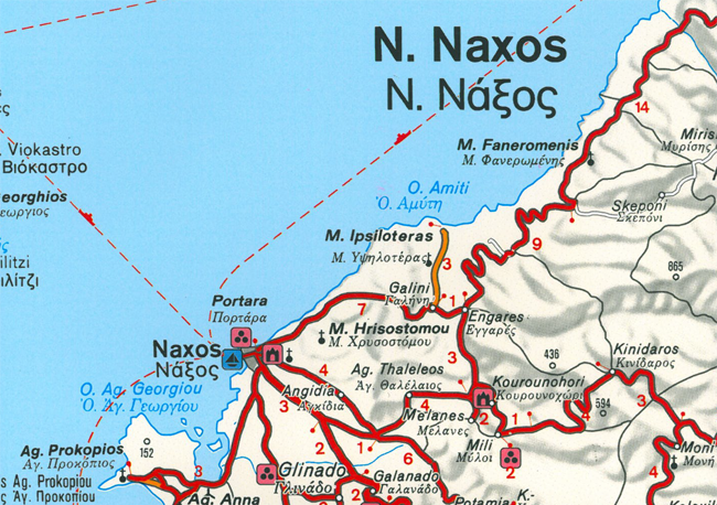
This map covers the following Andros, Tinos, Mykonos, Siros, Giaros, Kea, Kithnos, Serfios, Sifnos, Dilos, Kimolos, Milos, Poliegos, Folegandros, Sikinos, Ios, Santorini, Anafi, Andiparos, Paros, Naxos, Dnousa, Amorgos.

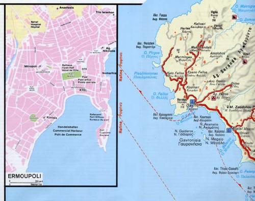
Inset maps of Mykonos, Ermoupoli, as well as antique site Thira, Katapoliani (Paros), Dilos, Hieron of Apollon. Touristic airports, castles, ruins, archaeological sites, religious buildings, caves, spas, marinas, anchorages, camping sites.

The legend is in English, Greek, German, Italian, and French. All place names are indicated in both Greek and Roman scripts.

add to wish list
€ 10.32
instead of € 12.90
quantity
- 1 +
ship to :: Italia
Corriere espresso € 6.00
availability
available
add to cart