en
wishlist
login
mail

contact us

Cartography

Hiking maps, maps and atlases, cartography around the world. Maps of the trails, cartography for cyclotourism and mountain biking

Mountain

Alpine guides, hiking guides, technical manuals for summer and winter mountaineering. Mountain literature and filmography

Sea

Nautical manuals, nautical cartography, books and literature for sailboat and motor

Travels

Travel guides and travel literature for Italy, Europe and the rest of the world

Military

Collection of the best publications (books and DVDs) on the mountain war on the Alps and the rest of Italy and Europe
back
-5%
Sentiero Italia CAI 3C Basilicata Campania
4LAND | Sentiero Italia | Bolzano | 2025 | Materiale: Polyart | 22,5 × 12,5 - 68 × 99 | 1:50.000

Sentiero Italia CAI 3C Basilicata Campania

Da San Severino Lucano a Senerchia

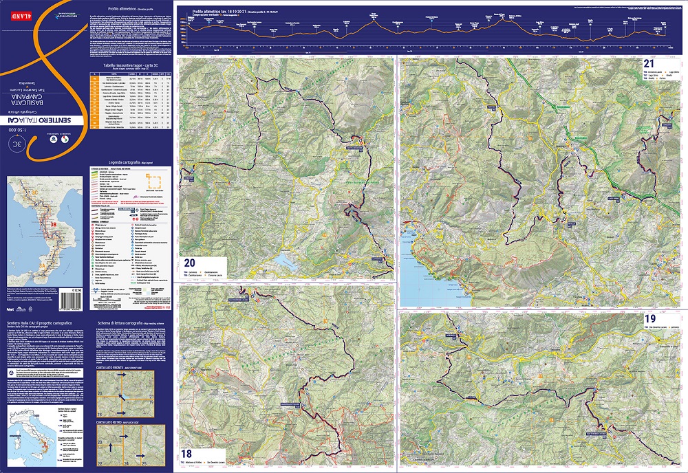
Il Sentiero Italia CAI (SI) è un sentiero a lunga percorrenza che, con uno sviluppo complessivo superiore ai 7.800 km, attraversa tutte le regioni d'Italia e le unisce in un unico itinerario. Parte da Santa Teresa di Gallura in Sardegna e, dopo avere attraversato le isole di Sardegna e Sicilia, risale l'intera dorsale appenninica per poi svilupparsi lungo il versante meridionale delle Alpi e concludersi a Murgia vicino a Trieste. Il Sentiero Italia CAI è costituito da oltre 500 tappe e da una rete di strutture ricettive ufficiali il cui numero è in continua crescita. Il progetto cartografico è strutturato come una collana di 28 carte stampate composte da "tavole" a scala 1:50.000 a copertura integrale del percorso del SI


add to wish list
€ 12.26
instead of € 12.90
quantity
- 1 +
ship to :: Italia
Corriere espresso € 6.00
availability
usually shipped within 5/10 days
add to cart