en
wishlist
login
mail

contact us

Cartography

Hiking maps, maps and atlases, cartography around the world. Maps of the trails, cartography for cyclotourism and mountain biking

Mountain

Alpine guides, hiking guides, technical manuals for summer and winter mountaineering. Mountain literature and filmography

Sea

Nautical manuals, nautical cartography, books and literature for sailboat and motor

Travels

Travel guides and travel literature for Italy, Europe and the rest of the world

Military

Collection of the best publications (books and DVDs) on the mountain war on the Alps and the rest of Italy and Europe
back
-5%
Sentiero Italia CAI 6B Emilia-Romagna - Toscana - Liguria
4LAND | Sentiero Italia | Bolzano | 2025 | Materiale: Polyart | 22,5 × 12,5 - 68 × 99 | 1:50.000

Sentiero Italia CAI 6B Emilia-Romagna - Toscana - Liguria

Da San Pellegrino in Alpe a Colle di Cadibona

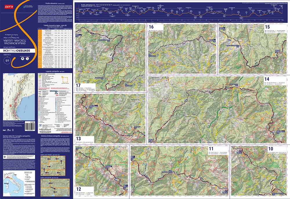
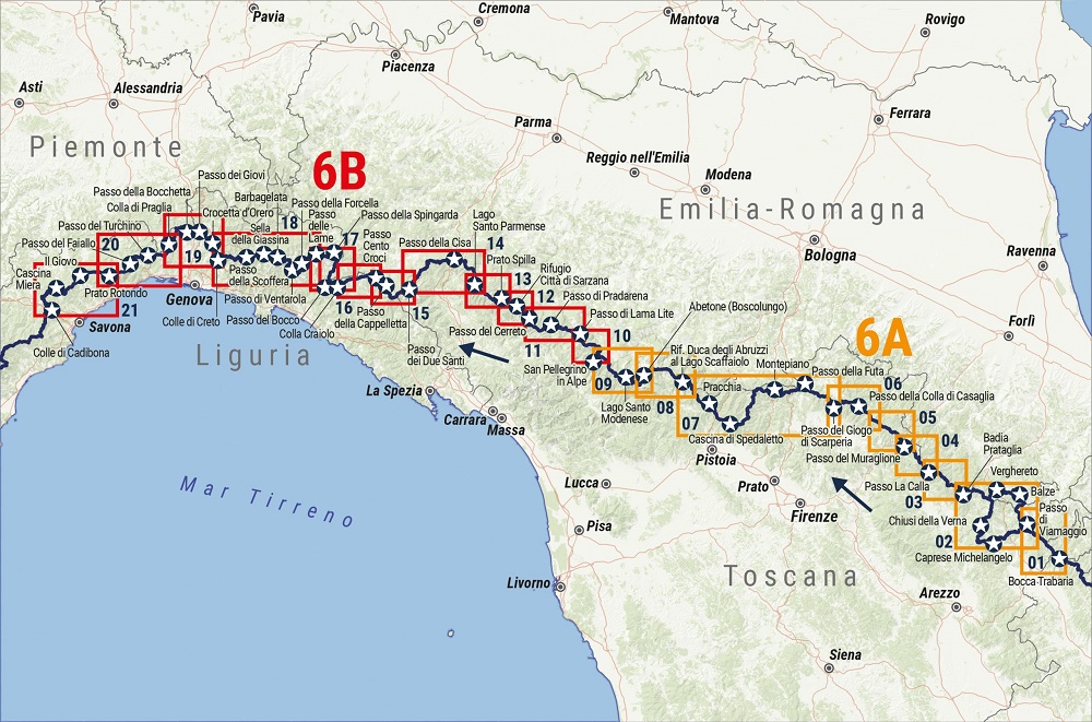
Le due carte 6A e 6B illustrano tutto il settore di Sentiero Italia nell’Appennino Settentrionale, dai boschi del Casentino, del Mugello e della Romagna, ai panoramici crinali sferzati dal vento dell’Appennino Tosco-Emiliano, fino alle dorsali affacciate sul mare dell’Appennino Ligure. I dati del percorso 6 (comprese le varianti): 49 tappe, 633,4 km, 22.596 m D+.

Stampa: fronte/retro


add to wish list
€ 12.26
instead of € 12.90
quantity
- 1 +
ship to :: Italia
Corriere espresso € 6.00
availability
usually shipped within 5/10 days
add to cart