en
wishlist
login
mail

contact us

Cartography

Hiking maps, maps and atlases, cartography around the world. Maps of the trails, cartography for cyclotourism and mountain biking

Mountain

Alpine guides, hiking guides, technical manuals for summer and winter mountaineering. Mountain literature and filmography

Sea

Nautical manuals, nautical cartography, books and literature for sailboat and motor

Travels

Travel guides and travel literature for Italy, Europe and the rest of the world

Military

Collection of the best publications (books and DVDs) on the mountain war on the Alps and the rest of Italy and Europe
back
Rasos de Peguera - Serra d'Ensija - Queralt - Vallcebre
Editorial Alpina | Spagna | Edició: 2025-2026 | 11,5 x 20,5 | 1: 25.000

Rasos de Peguera - Serra d'Ensija - Queralt - Vallcebre

Nueva edición totalmente revisada y actualizada del mapa de Rasos de Peguera-Serra d’Ensija, uno de los sectores más concurridos del Prepirineo oriental, que cuenta con una extensa red de senderos señalizados: GR, PR y, sobre todo, senderos locales del Berguedà.

•Hiking map and folder
•Scale 1:25.000
•Equidistance contours: 10 m distance
•Master contours: at 50 m
•Shady relief
•Compatible with GPS
•Marked routes
•Land use symbolized at three levels
•Folder with hikes, potholing, gully descent, climbing, mountain biking and all the facts of  interest


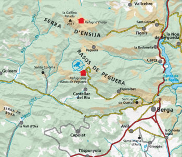
Ámbito del mapa: Prepirineo Catalán. Alt Berguedà
Características: mapa topográfico a escala 1:25.000 con información de interés excursionista y natural: senderos señalizados (GR’s, PR’s y SL), caminos, elementos de interés natural y cultural, arqueología...

Carpeta desplegable: Itinerarios, Refugios guardados, Información de interés, Puntos de interés

add to wish list
€ 17.00
quantity
- 1 +
ship to :: Italia
Corriere espresso € 6.00
availability
usually shipped within 15/30 days
add to cart