


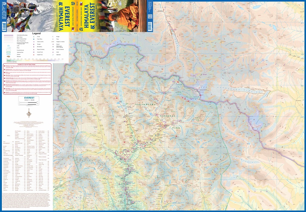
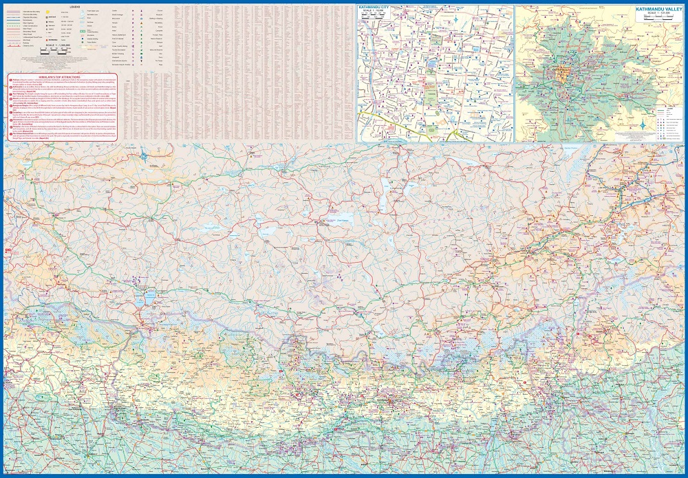
Detailed physical map with altitude lines and tourist information from the Everest area on one side of the map, the Himalay mountain chain is on the other side.
The climbing season for Everest begins in May. Time to start planning that little jaunt you’ve always wanted to do! Seriously, this is a lovely double-sided map with two attractive covers. The Everest side covers the mountain itself, with base camps and accommodations clearly shown. There are actually several interesting trails one could explore and all are shown; only one leads to the summit. The reverse side shows the entire Himalaya ‘knot’ that forms the basis for so many mountain chains. The area of coverage includes all of Nepal and Sikkim, a significant portion of Bhutan, most of Tibet, and a bit of northern India. All roads and attractions are shown. The map includes a detailed inset map for Kathmandu and another for the valley region surrounding the city. There are now half a dozen access roads into Nepal, and all are shown. East-west travel is finally available with the completion of Hwy 1401.