en
wishlist
login
mail

contact us

Cartography

Hiking maps, maps and atlases, cartography around the world. Maps of the trails, cartography for cyclotourism and mountain biking

Mountain

Alpine guides, hiking guides, technical manuals for summer and winter mountaineering. Mountain literature and filmography

Sea

Nautical manuals, nautical cartography, books and literature for sailboat and motor

Travels

Travel guides and travel literature for Italy, Europe and the rest of the world

Military

Collection of the best publications (books and DVDs) on the mountain war on the Alps and the rest of Italy and Europe
back
-5%
Laugavegur Trail - Fimmvorduhals Trail. Il sentiero delle sorgenti calde
Geo4Map libreria geografica | Carte escursionistiche | Novara | 05/2024 | pagine 64 - impermeabile, antistrappo | 11,5 x 23,5 | 1:25.000

Laugavegur Trail - Fimmvorduhals Trail. Il sentiero delle sorgenti calde

Guida e atlante cartografico

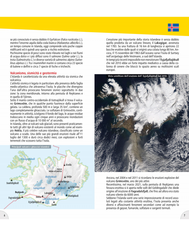
Il Laugavegur Trail in Islanda è un'esperienza di trekking indimenticabile lunga circa 55 km.

Attraverso paesaggi sorprendenti di vulcani, ghiacciai e sorgenti termali, offre un'immersione unica nella natura islandese.

Il percorso può durare da 4 a 6 giorni, ed è popolare durante l'estate per temperature miti e giorni lunghi, ma anche a inizio autunno per un'esperienza più intima.

Camminare lungo Laugavegur Trail va oltre il semplice trekking, è un viaggio nell'incanto incontaminato dell'Islanda.

add to wish list
€ 14.25
instead of € 15.00
quantity
- 1 +
ship to :: Italia
Corriere espresso € 6.00
availability
usually shipped within 5/10 days
add to cart