en
wishlist
login
mail

contact us

Cartography

Hiking maps, maps and atlases, cartography around the world. Maps of the trails, cartography for cyclotourism and mountain biking

Mountain

Alpine guides, hiking guides, technical manuals for summer and winter mountaineering. Mountain literature and filmography

Sea

Nautical manuals, nautical cartography, books and literature for sailboat and motor

Travels

Travel guides and travel literature for Italy, Europe and the rest of the world

Military

Collection of the best publications (books and DVDs) on the mountain war on the Alps and the rest of Italy and Europe
back
-5%
Sentiero Italia CAI 4A Campania
4LAND | Sentiero Italia | Bolzano | 12/2023 | Materiale: Polyart | 22,5 × 12,5 - 68 × 99 | 1:50.000

Sentiero Italia CAI 4A Campania

Senerchia - Isernia

Questa collezione permette di compiere un percorso a piedi molto vario per sensazioni, atmosfere e ambienti attraversati: le grandi distese ondulate delle Murge contrastano con i boschi e i torrenti dei Monti Picentini, gli spettacolari affacci sul mare dei Monti Lattari con il fascino discreto dei boschi del Matese.

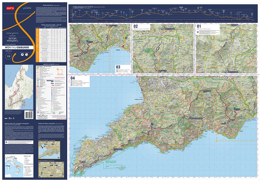
Carta ufficiale del Sentiero Italia CAI a scala 1:50.000 che da Senerchia arriva a Campitello Matese attraversando diversi Parchi (Monti Picentini, Taburno-Camposauro, Matese) e con alcune tavole dedicate al Parco dei Monti Lattari. Il tutto rappresentato in 10 tavole cartografiche di grande dettaglio e di comoda lettura accompagnate da un profilo altimetrico e i dati statistici di tutte le tappe. Carta stampata su materiale impermeabile, anti-strappo e riciclabile.

Stampa: fronte/retro


add to wish list
€ 12.26
instead of € 12.90
quantity
- 1 +
ship to :: Italia
Corriere espresso € 6.00
availability
usually shipped within 5/10 days
add to cart