


contact us
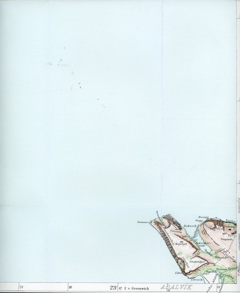
Atlas sheets were originally made by Danish surveyors during the first four decades of the 20th century. The 87 sheets are considered to be among the most beautiful maps of Iceland. The Atlas Maps show the land surface in considerable detail, with 20-metre contour line intervals, roads, tracks, and many place names. The making of these maps were a great achievement at the time, and are an important part of Iceland's cultural heritage.
I fogli dell'Atlante furono originariamente realizzati dai geometri danesi durante i primi quattro decenni del XX secolo. Gli 87 fogli sono considerati tra le mappe più belle dell'Islanda. Le mappe dell'Atlante mostrano la superficie terrestre in modo molto dettagliato, con intervalli di 20 metri tra le linee di contorno, strade, piste e molti toponimi. La realizzazione di queste mappe fu un grande risultato all'epoca e sono una parte importante del patrimonio culturale dell'Islanda.