


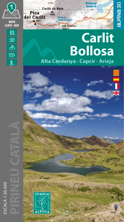
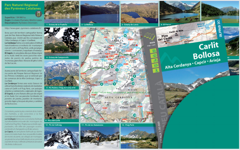
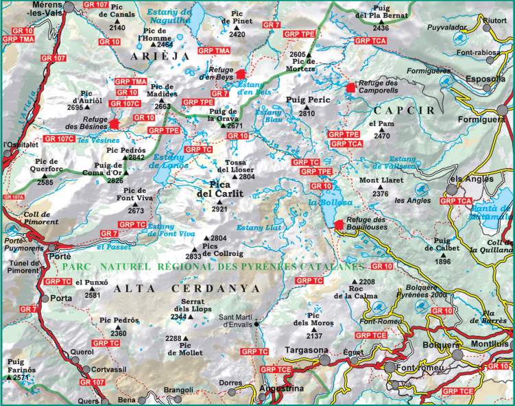
L’étendue de la carte couvre une zone entre la Haute-Cerdagne, le Capcir et l’Ariège, un environnement privilégié pour la randonnée avec des paysages de haute montagne impressionnants. On y trouve des sommets emblématiques comme le Carlit (2 921 m) et le Puig Peric (2 810 m), ainsi que de vastes zones lacustres formées par des lacs d’origine glaciaire.
Secteur de la carte : Pyrénées catalanes. Cerdagne, Capcir et Ariège.
Secteur Carlit, Bouillouses et Puig Peric.
Caractéristiques de la carte : Carte topographique 1:30.000 avec des informations d’intérêt pour les randonneurs: abris, sentiers balisés (GR, PR, sentiers locaux), sentiers de montagne, etc.
Le rabat pliable comprend :
• Refuges gardés · Zones protégées
• Randonnées · Sites incontournables
Langues : catalan, espagnol, anglais et français
The map area covers a region between Haute-Cerdagne, Capcir, and Ariège, a prime destination for hiking with stunning high mountain landscapes. It features iconic peaks such as Carlit (2,921 m) and Puig Peric (2,810 m), along with extensive lake areas formed by glacial origin lakes.Area of the map: Catalan Pyrenees. Cerdagne, Capcir and Ariège.
Sector Carlit, Bouillouses and Puig Peric.
Map features: topographic map, with information of hiking interest: refuges, signposted trails (GR’s, PR’s, local trails), ascent routes to the summits, access to excursion bases, etc.
The folding fl ap includes:
• Mountain huts · Protected areas
• Hikes · Highlights
Languages: catalan, spanish, english and french