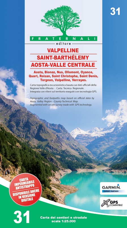
31 - Valpelline, Saint Barthélemy, Aosta – Valle Centrale
GPS compatibile
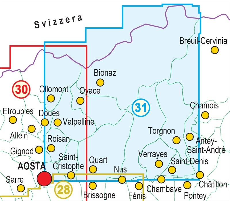
Comuni interessati dalla cartografia:
Aosta, Bionaz, Nus, Ollomont, Oyace, Quart, Roisan, Saint Christophe, Saint Denis, Torgnon, Valpelline, Verrayes.
indicazione di tutti i tratti di sentiero in cui siano presenti delle corde fisse
simbologia dedicata alle piante monumentali
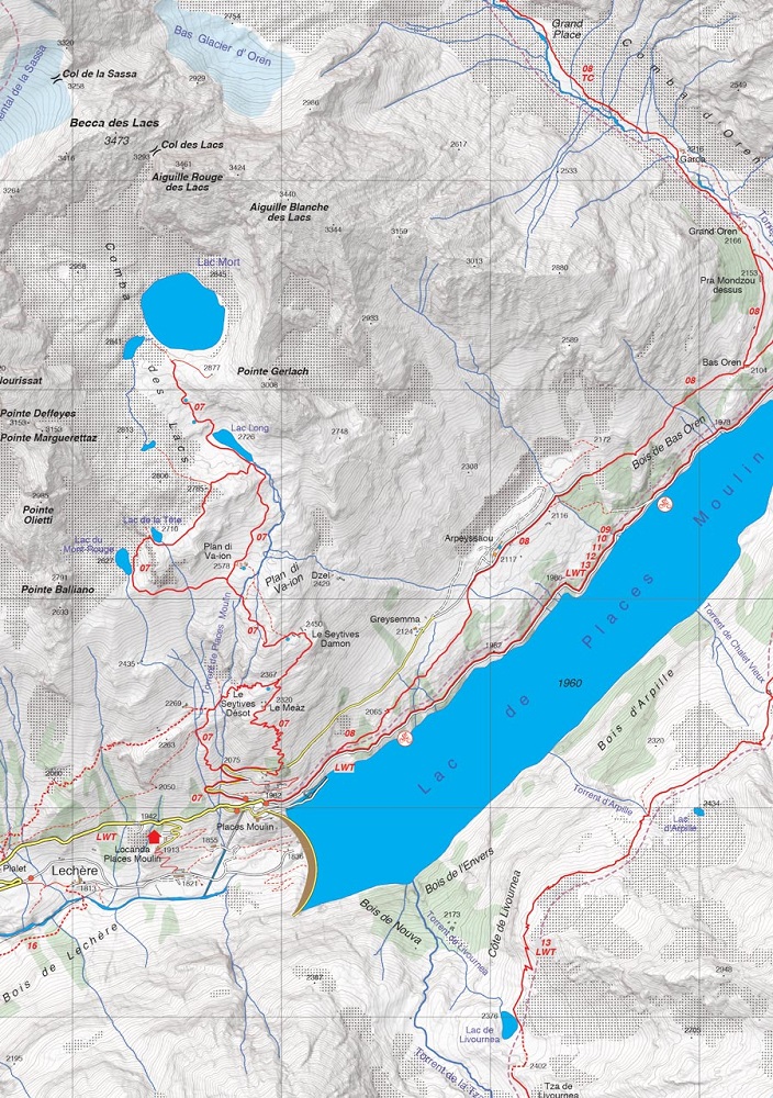
Per la realizzazione di questa mappa cartacea sono stati percorsi a piedi centinaia di km su strade e sentieri registrando i tracciati con tecnologia gps. Questa tecnica di lavoro ci permette di ottenere una precisa collocazione di tutti gli elementi utili ad un escursionista.
La carta è basata sulla creazione di un database geografico completo, strutturato su software GIS con i seguenti livelli:
- Informazioni escursionistiche (rifugi, bivacchi, rifugi non custoditi, pareti d’arrampicata, aree attrezzate, luoghi d’interesse, vie ferrate, passaggi pericolosi, ecc.)
- Legende cartografiche ed informazioni generali (tutte interamente tradotte in inglese, francese, tedesco)
- Elementi puntuali tipo fontane, piloni e croci, divieti d’accesso, grotte, ecc.
- Percorsi sci-alpinistici
- Percorsi mountain bike
- Rete sentieristica primaria e secondaria
- Denominazione sentieri ed itinerari escursionistici
- Rete stradale completa
- Tipologia di terreno (Aree boschive, pietraie, ghiacciai, ecc.)
- Laghi, fiumi, rii
- Confini di stato, regionali, provinciali, comunali, parchi nazionali
- Curve di livello equidistanza 50m, 10m, 5m
- Edifici, industrie, chiese, cimiteri
- Costruzioni militari, fortificazioni
- Toponomastica completa
- Stazioni ferroviarie, uscite autostradali
Questa carta contiene, inoltre, un reticolato metrico indicato in cornice secondo la proiezione UTM WGS84.
index


