


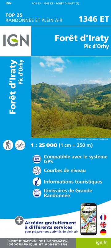
L'indispensable carte de randonnée IGN 1346ET. D'une très grande précision elle contient tous les détails existant sur le terrain : voies de communication et sentiers, constructions y compris les hangars, bois, arbres isolés, rivières, sources, sans oublier la représentation du relief par des courbes de niveau. Les sentiers balisés et les informations touristiques sont également représentés.
Communes couvertes : Estérençuby, Lecumberry, Bustince-Iriberry, Jaxu, Saint-Just-Ibarre, Larrau, Lacarry-Arhan-Charritte-de-Haut, Musculdy, Bunus, Caro, Saint-Jean-le-Vieux, Ibarrolle, Gamarthe, Lacarre, Béhorléguy, Mendive, Bussunarits-Sarrasquette
Lieux à découvrir : Embalse de Irabia,Forêt d'Iraty, Bosque del Irati, Forêt des Arbailles, Sommet d'Occabe, Col d'Orgambidé, Port de Larrau, Sommet d'Errozaté, Pic d'Orhy, Col d'Osquich, Pic des Escaliers, Pic de Behorleguy, Pic de Belchou, Col d'Orgambidexka, Sierra de Abodi, Massif des Arbailles, Fontaine d'Ahüzkia, St-Sauveur, St-Antoine, Chapelle St-Blaise, Source de la Nive, Château Harispe, Dolmen de Chuberam, Source de la Bidouze