


contact us

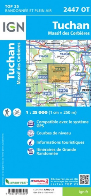
L'indispensable carte de randonnée IGN 2447OT. D'une très grande précision elle contient tous les détails existants sur le terrain : voies de communication jusqu'au moindre sentier, constructions jusqu'au hangar, bois, arbre isolé, rivière, source... Sans oublier la représentation du relief par des courbes de niveau. Les sentiers balisés et les informations touristiques sont également représentées.
Communes couvertes : Tuchan, Massif des Corbières, Paziols, Mouthoumet, Albières, Soulatgé, Cubières-sur-Cinoble, Villerouge-Termenès, Duilhac-sous-Peyrepertuse, Maury, Cucugnan, Rouffiac-des-Corbières, Padern, Tuchan, Saint-Paul-de-Fenouillet, Prugnanes, Salza, Montjoi, Laroque-de-Fa, Cascastel,
Lieux à découvrir : Forêt Domaniale de l'Orme Mort,Gorges de l'Orbieu, Gorges de Terminet, Gorges de Galamus Ermitage St-Antoine de Galamus, Château de Peyrepertuse, Château de Durfort, Dolmen dit Table des Morts, Château de Termes, Grau de Maury, Moulin d'Omer, Château d'Aguilar, Château de Quéribus