


contact us
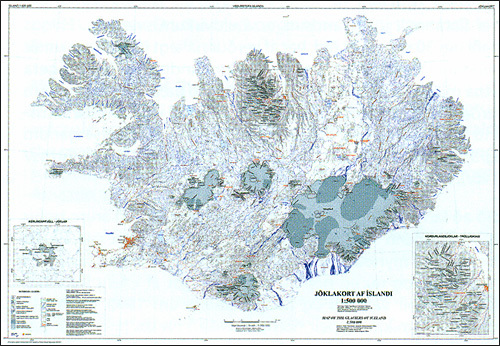
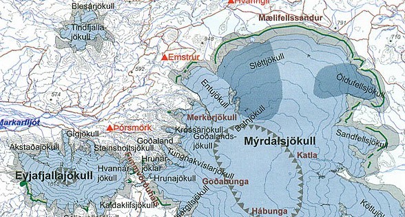
Overview map of Iceland at 1:500,000 showing the changes in the extent of its glacier cover since the Little Ice Age maximum around 1890 to the beginning of 2000s, with additional markings for glacier margins around 1945.
The base map presents the country’s topography by contours at 100m intervals with spot heights, rivers and lakes, and shows the road network with towns and selected settlements. Locations of tourist huts and shelters are prominently highlighted. Colouring and/or graphics indicate the ice cap, outlet/mountain/surge-type glaciers, and the extent of the glacier cover in the Little Ice Age, in 1945 and at the beginning of this century. Latitude and longitude lines are drawn at 1º and 2º respectively.
Two areas: Kerlingarfjöll –Jöklar in central Iceland and Nordurlandsjöklar – Tröllaskagi in the north near Akureyri are presented in greater detail on enlargements. Map legend and an accompanying leaflet include English.