


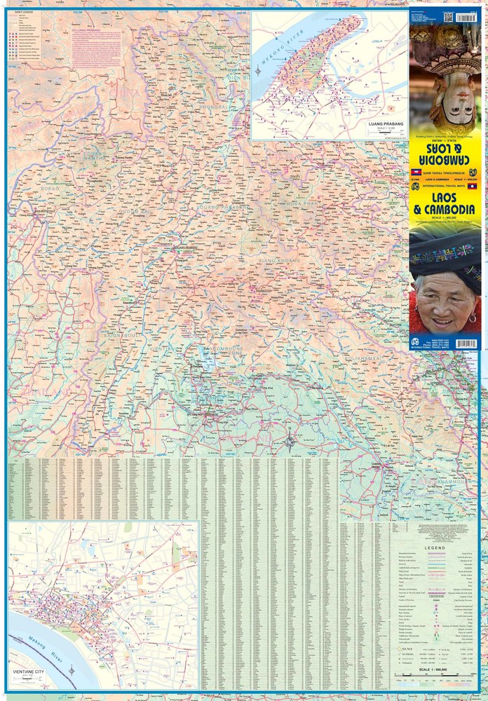
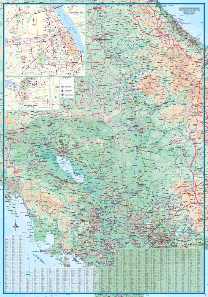
Cambodia and Laos at 1:900,000 on a double-sided, indexed map from ITMB with and insets street plans of Phnom Penh, Vientiane and Luang Prabang, plus an, an enlargement for the Angkor area highlighting location of various temples.
The map divides the two countries so that all of Cambodia is on one side; Laos is divided north/south with a good overlap between the sides. Altitude colouring and peak heights presents the topography, with marshes and areas subject to inundation also indicated. Road network includes selected minor roads, tracks and trails, with intermediate distances marked on main routes and border crossings marked. Railways, ferry routes over the Cambodian waterways and local airports are shown. Provincial and district borders and national parks are marked, and symbols highlight various places of tourist interest: temples, bird sanctuaries, beaches, cave, etc. Latitude and longitude lines are drawn at 1° intervals. Each side has a separate index.
An inset map at 1:150,000 shows the area around Siem Riep in greater detail highlighting its numerous temples, plus selected accommodation and tourist facilities. Also provided are street plans of Phnom Penh, Vientiane and Luang Prabang on which various landmarks and buildings are marked e.g. embassies, hotels, pagodas, information centres, bus terminals, markets, etc.