


contact us
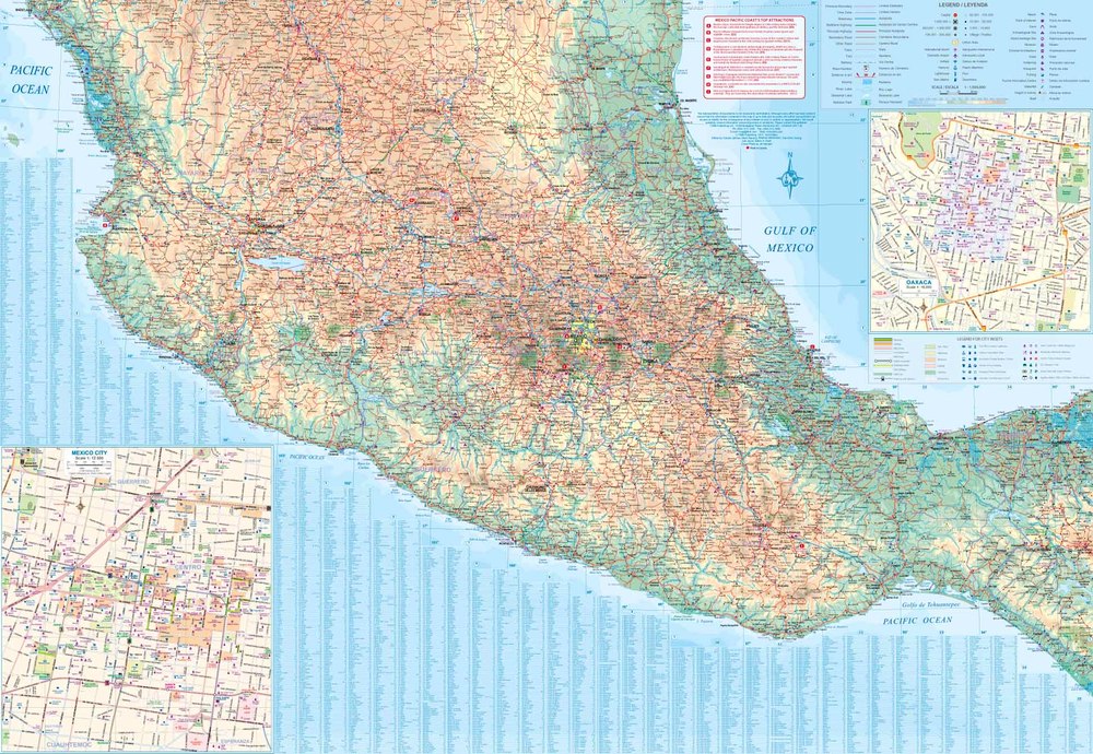
Road map covering south-western Mexico, with indexed plan of central Guadalajara on the reverse. The main map extends from Acapulco in the south-east to Durango in the north and Mazatlan in the west.
Road detail includes some minor roads and tracks and shows locations of selected petrol stations and intermediate distances on major routes. Main railways and province boundaries are drawn and a range of symbols show local airports and airfields, archaeological sites, places of interest, beaches etc.
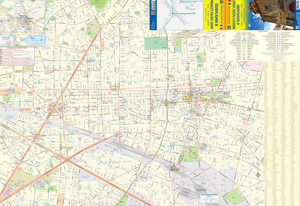
The clear, indexed plan of Guadalajara covers a substantial part of the city, from the main railway station and freight yard in the south to Chapultepec Country in the north and from Los Arcos in the west to San Juan de Dios in the east. Notable buildings, institutions and attractions are highlighted, railway and subway lines and stations are marked and symbols show petrol stations, car parks, hotels, tourism offices, museums, places of interest etc. A diagram of the metro system is also included and another small inset shows the major communication routes in the in the area around the city.