


contact us
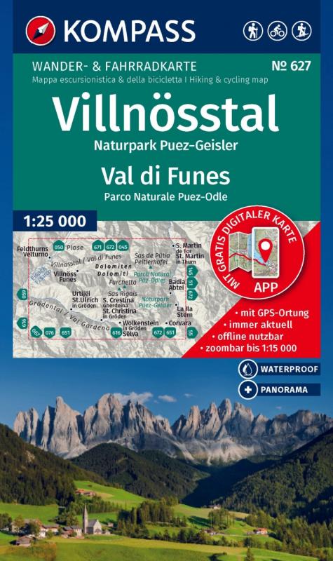
Le mappe escursionistiche KOMPASS contengono tutto ciò che devi sapere sull'escursionismo, come i sentieri escursionistici attuali, i percorsi consigliati e le importanti informazioni turistiche.
Le mappe escursionistiche KOMPASS convincono con
- una mappa GPS accurata e aggiornata per un facile orientamento
- ottica a misura di lettura nella scala ideale di 1: 25.000 / 1: 35.000 o 1: 50.000.
Informa su luoghi e rifugi, nonché tour consigliati, attrazioni e strutture per il tempo libero. Le mappe KOMPASS accurate per il GPS sono perfette per il tuo prossimo tour! La scala di facile lettura e le informazioni utili sulla regione semplificano la pianificazione. Le mappe KOMPASS contengono tutto ciò che vale la pena sapere per gli intenditori di outdoor. Sentieri escursionistici e ciclabili con segni a seconda del livello di difficoltà, le corrispondenti linee di contorno e forme di vegetazione, nonché informazioni turistiche complete.