en
wishlist
login
mail

contact us

Cartography

Hiking maps, maps and atlases, cartography around the world. Maps of the trails, cartography for cyclotourism and mountain biking

Mountain

Alpine guides, hiking guides, technical manuals for summer and winter mountaineering. Mountain literature and filmography

Sea

Nautical manuals, nautical cartography, books and literature for sailboat and motor

Travels

Travel guides and travel literature for Italy, Europe and the rest of the world

Military

Collection of the best publications (books and DVDs) on the mountain war on the Alps and the rest of Italy and Europe
back
Cyclades - Argosaronic islands (R1)
Anavasi | Regionali 1:200.000 / 1:250.000 | Grecia | 05/2024 | impermeabile | 14 x 24 | 1:200.000

Cyclades - Argosaronic islands (R1)

1:200.000

Cyclades - Argosaronic islands [R1] is new map covering the areas of Attica with the Argosaronic islands of Salamina, Aegina, Ydra and Poros and all the Cyclades islands, printed on 2 sides with overlap.
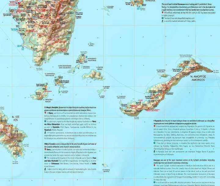
A very useful map, especially for island-hoppers, with short text for each island presenting the main monuments, outstanding beaches and hiking trails on each island.
Printed on waterproof, polyart paper

GPS compatibile

index
add to wish list
€ 11.00
quantity
- 1 +
ship to :: Italia
Corriere espresso € 6.00
availability
usually shipped within 15/30 days
add to cart