


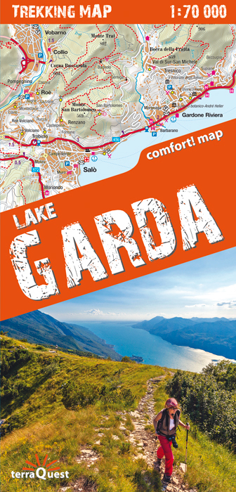

Lake Garda and the surrounding area on a waterproof and tear-resistant, contoured and GPS compatible map at 1:70,000 from terraQuest, highlighting hiking trails, campsites and refuges, etc. The map is presented in a special format handy for conveniently viewing just small sections of it at one time.
Coverage starts south of the A4 motorway, extends beyond the northern tip of the lake, and includes Verona. Topography is presented by contours at 20m intervals, enhanced by relief shading plus spot heights for local mountain peaks. Numerous hiking trails are highlighted and symbols indicate different accommodation options (campsites, refuges and shelters, hotels, agriturismo farms), restaurants and cafes, various places of interest, etc. Local roads show locations of car parks and petrol stations and on the lake ferry connections are marked. The map has latitude and longitude lines at intervals of 1’. Map legend includes English.
The map is laminated in a format similar to the old cloth-dissected maps so that sections of it can be easily folded back without damage, and can be annotated with write-on/wipe-off marker pens.
Language: English, French, German