


contact us
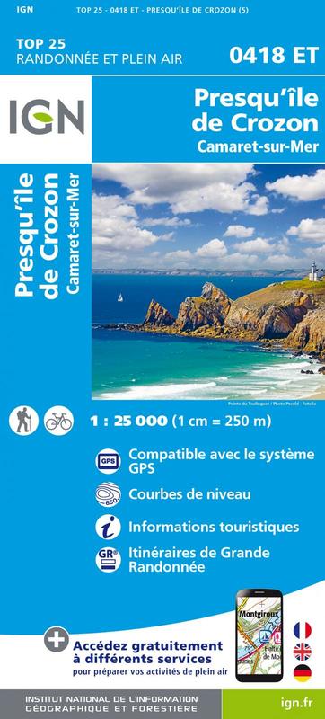
L'indispensable carte de randonnée IGN 0418ET. D'une très grande précision elle contient tous les détails existants sur le terrain : voies de communication jusqu'au moindre sentier, constructions jusqu'au hangar, bois, arbre isolé, rivière, source... Sans oublier la représentation du relief par des courbes de niveau. Les sentiers balisés et les informations touristiques sont également représentés.
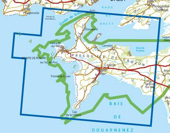
Communes couvertes : Crozon, Camaret-sur-Mer, Landévennec, Plougastel-Daoulas, Roscanvel, Telgruc-sur-Mer, Lanvéoc
Lieux à découvrir : Parc naturel régional d'Armorique,Anse de Poulmic, Rade de Brest, Pointe des Espagnols, les Tas de Pois, Pointe de Pen-Hir, Pointe du Petit Minou, Cap de la Chèvre, Pointe de Dinan, Presqu'île de Crozon, Notre-Dame de Roc'h Amadour, St-Fiacre, Tour Vauban, Pointe des Grottes