en
wishlist
login
mail

contact us

Cartography

Hiking maps, maps and atlases, cartography around the world. Maps of the trails, cartography for cyclotourism and mountain biking

Mountain

Alpine guides, hiking guides, technical manuals for summer and winter mountaineering. Mountain literature and filmography

Sea

Nautical manuals, nautical cartography, books and literature for sailboat and motor

Travels

Travel guides and travel literature for Italy, Europe and the rest of the world

Military

Collection of the best publications (books and DVDs) on the mountain war on the Alps and the rest of Italy and Europe
back
Chasses du roi - carte de Versailles 1764-1773

Chasses du roi - carte de Versailles 1764-1773

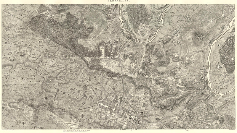
La carte de Versailles a été terminée en 1768 et réduite (de 1775 à 1782 pour les 12 feuilles) au 1:28.800 par les ingénieurs  géographes des Camps et armées Cottereau, Dauchet, Delplanque, Ducaille, Gaultier et Hervet.

Extrait de la brochure de Marcel Huguenin "la carte des chasses au 1:28.800 (1764-1773)

add to wish list
€ 39.50
quantity
- 1 +
ship to :: Italia
Corriere espresso € 6.00
availability
temporarily unavailable
notify when available