


contact us
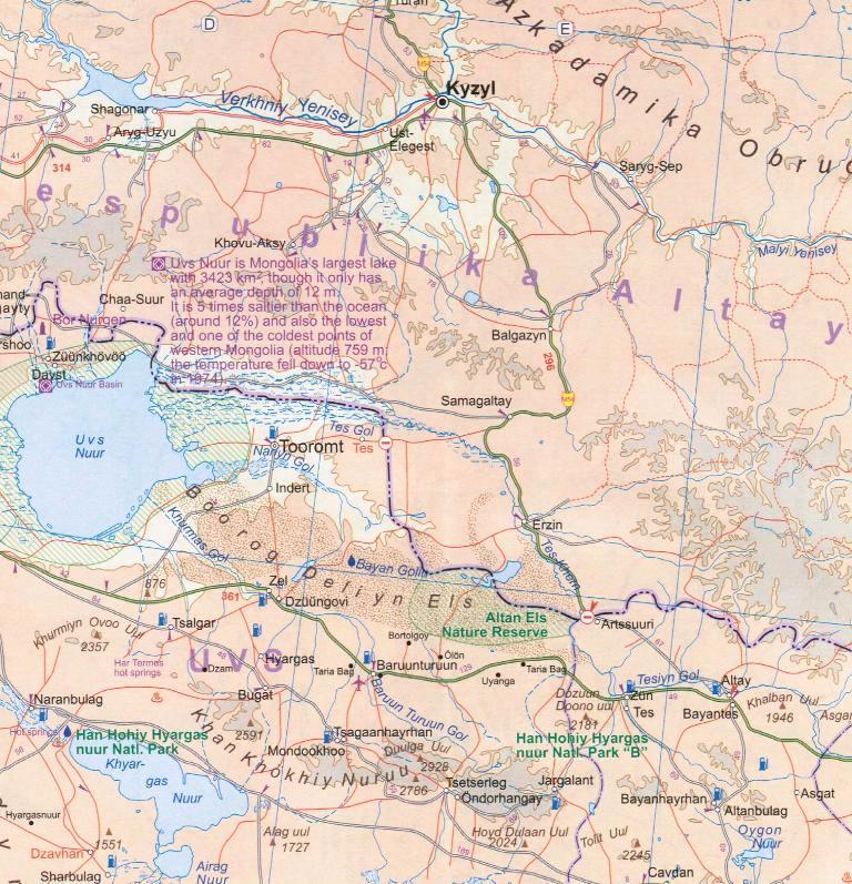
Mongolia on a double-sided, indexed map with altitude colouring to show the country’s topography, plus a large street plan of central Ulaanbaatar annotated with hotels and places of interest. All place names are shown transliterated.
The map divides the country east/west with a very generous overlap between the sides. Topography is shown by bold altitude colouring with graphics for swamps, glaciers, sand dunes, water wells etc. National parks and protected areas are highlighted. Road network indicates partially paved and unpaved roads, includes selected tracks and shows locations of border crossings from Russia or China and petrol stations. Driving distances are shown on main and many local routes. Railway lines are included and domestic airports are marked. The map also shows internal administrative boundaries with names of the provinces and highlights various places of interest.
A large, clear street plan shows the town centre of Ulaanbaatar, highlighting several hotels, foreign embassies, and various places of interest. Also provided is an inset showing the county's natural zones (taiga, steppe, desert etc).