en
wishlist
login
mail

contact us

Cartography

Hiking maps, maps and atlases, cartography around the world. Maps of the trails, cartography for cyclotourism and mountain biking

Mountain

Alpine guides, hiking guides, technical manuals for summer and winter mountaineering. Mountain literature and filmography

Sea

Nautical manuals, nautical cartography, books and literature for sailboat and motor

Travels

Travel guides and travel literature for Italy, Europe and the rest of the world

Military

Collection of the best publications (books and DVDs) on the mountain war on the Alps and the rest of Italy and Europe
back
201 Alsace / Massif des Vosges
IGN Francia - Institut Géographique National | TOP 200 | Francia | 3/2018 | 11 x 25 | 1:200.000

201 Alsace / Massif des Vosges

1:200.000

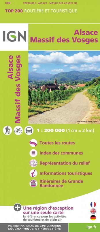
La référence pour les activités de tourisme et de plein air. Une région d’exception sur une seule carte. L’intégralité du réseau autoroutier et routier : l’idéal pour les déplacements en voiture et le cyclotourisme.
Des informations touristiques détaillées, pratiques pour découvrir une région. Les GR® : la référence pour planifier ses randonnées.
La représentation du relief, indispensable pour les régions montagneuses (courbes de niveau, points côtés, estompage). un index de toutes les communes pour se repérer facilement.

add to wish list
€ 8.50
quantity
- 1 +
ship to :: Italia
Corriere espresso € 6.00
availability
temporarily unavailable
notify when available