


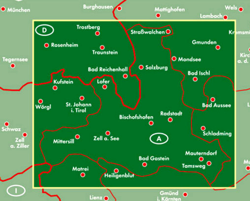
Le carte per auto freytag & berndt sono disponibili per molti paesi e regioni in tutto il mondo. Oltre al design chiaro, la carta stradale "Salisburgo 1:150.000" contiene molte informazioni aggiuntive come le condizioni delle strade, le attrazioni, i campeggi e numerose mappe del centro città (Bad Gastein, Bischofshofen, Hallein, Mittersill, Salisburgo, Radstadt, St Johann im Pongau, Tamsweg e Zell am See). L'ampio registro delle posizioni consente inoltre un rapido orientamento. La serie “Top 10 Tips” offre un piccolo supplemento in cui le dieci attrazioni più importanti e le dieci piste ciclabili più belle della regione vengono brevemente descritte in diverse lingue.
I 10 migliori consigli per attrazioni, piste ciclabili, mappe delle città: Bad Gastein, Bischofshofen, Hallein, Mittersill, Salisburgo, Radstadt, St. Johann im Pongau, Tamsweg, Zell am See;
Sprachen: Deutsch, Englisch, Französisch, Italienisch