en
wishlist
login
mail

contact us

Cartography

Hiking maps, maps and atlases, cartography around the world. Maps of the trails, cartography for cyclotourism and mountain biking

Mountain

Alpine guides, hiking guides, technical manuals for summer and winter mountaineering. Mountain literature and filmography

Sea

Nautical manuals, nautical cartography, books and literature for sailboat and motor

Travels

Travel guides and travel literature for Italy, Europe and the rest of the world

Military

Collection of the best publications (books and DVDs) on the mountain war on the Alps and the rest of Italy and Europe
back
Carinzia
Freytag & Berndt | Carte stradali / atlanti | Austria | 13 x 25,5 | 1:150.000

Carinzia

1:150.000

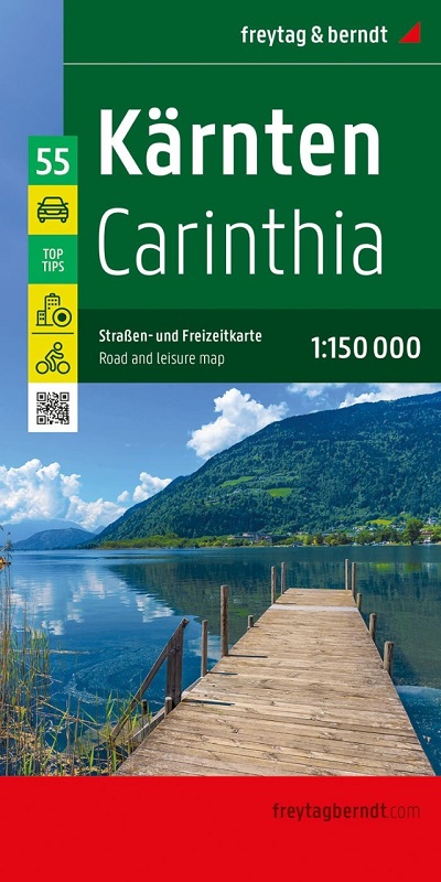
La carta stradale e per il tempo libero della Carinzia in scala 1:150.000 contiene molte informazioni utili e utili per un viaggio nel sud dell'Austria.
La complessa rete stradale e ferroviaria è illustrata in dettaglio e sulla mappa sono rappresentate numerose piste ciclabili regionali e piste ciclabili a lunga percorrenza. Le strade turistiche e le strade panoramiche sono evidenziate a colori e sono visibili molte destinazioni attraenti.

Grazie alla cartografia precisa di Freytag & Berndt e alla scala ideale, la carta stradale e per il tempo libero può essere utilizzata come strumento ideale per scopi di pianificazione e orientamento.

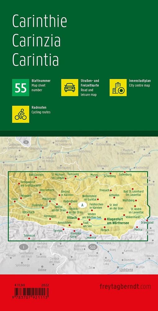
Mappe delle città di Klagenfurt, Villach, Friesach, Feldkirchen in Carinzia, Gmünd in Carinzia, Hermagor, Spittal an der Drau, St. Veit an der Glan, Völkermarkt e Wolfsberg.

Lingua Tedesco

add to wish list
€ 12.90
quantity
- 1 +
ship to :: Italia
Corriere espresso € 6.00
availability
usually shipped within 15/30 days
add to cart