en
wishlist
login
mail

contact us

Cartography

Hiking maps, maps and atlases, cartography around the world. Maps of the trails, cartography for cyclotourism and mountain biking

Mountain

Alpine guides, hiking guides, technical manuals for summer and winter mountaineering. Mountain literature and filmography

Sea

Nautical manuals, nautical cartography, books and literature for sailboat and motor

Travels

Travel guides and travel literature for Italy, Europe and the rest of the world

Military

Collection of the best publications (books and DVDs) on the mountain war on the Alps and the rest of Italy and Europe
back
Eifel, Mosel. Hunsrück, Westerwald
Freytag & Berndt | Carte stradali / atlanti | Austria | 13 x 25,5 | 1:150.000

Eifel, Mosel. Hunsrück, Westerwald

1:150.000

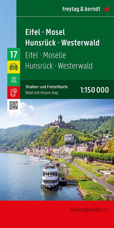
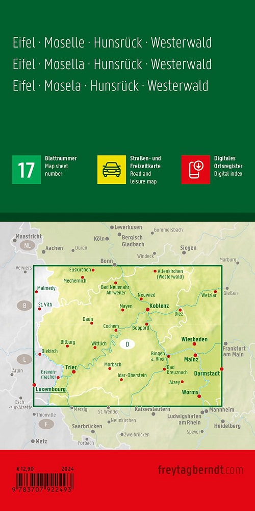
Con la carta stradale Eifel - Mosella - Hunsrück - Westerwald in scala 1:150.000 i vacanzieri che viaggiano in auto, moto o roulotte possono facilmente orientarsi. La fitta rete stradale è rappresentata con precisione, le distanze e le destinazioni turistiche sono indicate sulla mappa.

Informazioni turistiche
Campeggi e piazzole
Registro di localizzazione digitale
La carta auto ideale
Gli automobilisti e i motociclisti apprezzano particolarmente la cartografia precisa di Freytag & Berndt per la pianificazione e l'orientamento sul posto.
Naturalmente i caravanisti e i campeggiatori troveranno tutti i campeggi e le piazzole sulla mappa.
Registro di localizzazione digitale
Il registro locale con i codici postali è accessibile online e scaricabile in formato PDF.

add to wish list
€ 12.90
quantity
- 1 +
ship to :: Italia
Corriere espresso € 6.00
availability
usually shipped within 15/30 days
add to cart