en
wishlist
login
mail

contact us

Cartography

Hiking maps, maps and atlases, cartography around the world. Maps of the trails, cartography for cyclotourism and mountain biking

Mountain

Alpine guides, hiking guides, technical manuals for summer and winter mountaineering. Mountain literature and filmography

Sea

Nautical manuals, nautical cartography, books and literature for sailboat and motor

Travels

Travel guides and travel literature for Italy, Europe and the rest of the world

Military

Collection of the best publications (books and DVDs) on the mountain war on the Alps and the rest of Italy and Europe
back
Inghilterra sud-orientale. Carta stradale 1:250.000
Ordnance Survey ( U.K. ) | OS ROAD | U.K. | 2020 | 13,5x24 - 125x98 | 1:250.000

Inghilterra sud-orientale. Carta stradale 1:250.000

8 South East England

Pianifica il tuo viaggio con questa serie di mappe stradali di OS. Mostrando tutti i principali collegamenti stradali, ferroviari e traghetti, nonché insediamenti e punti di interesse selezionati in scala 1:250.000, questa mappa è ideale per pianificare viaggi e vacanze in auto o in bicicletta.

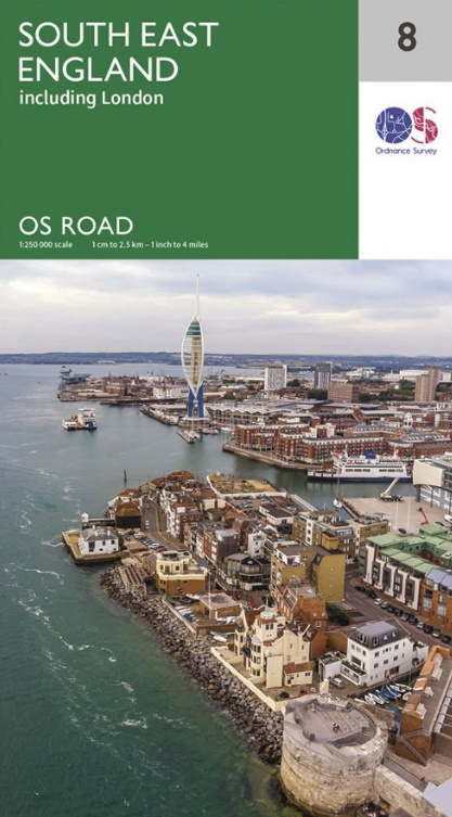
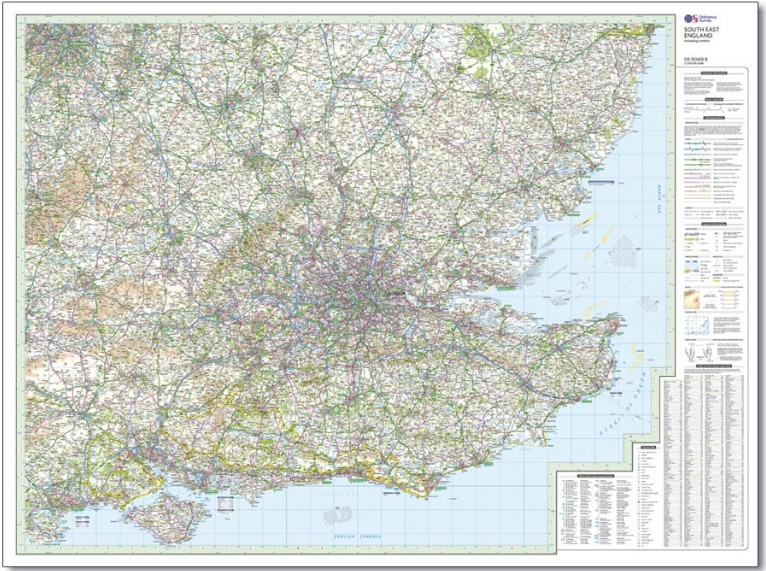
Plan your journey with this series of road maps from OS. Showing all major road, rail and ferry links as well as settlements and selected features in 1: 250 000 scale, this is the ideal map for planning trips and holidays by car or cycle.

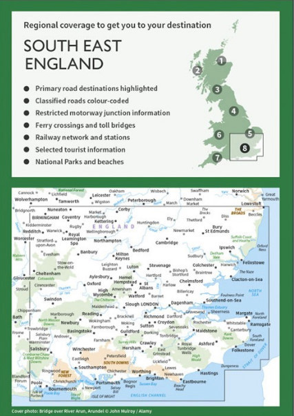
OS Road 8 covers the south-east England.

index
add to wish list
€ 12.00
quantity
- 1 +
ship to :: Italia
Corriere espresso € 6.00
availability
usually shipped within 15/30 days
add to cart