


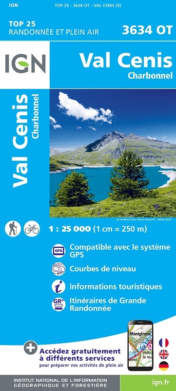
L'indispensable carte de randonnée IGN 3634OT. D'une très grande précision elle contient tous les détails existants sur le terrain : voies de communication jusqu'au moindre sentier, constructions jusqu'au hangar, bois, arbre isolé, rivière, source... Sans oublier la représentation du relief par des courbes de niveau. Les sentiers balisés et les informations touristiques sont également représentés.
Communes couvertes : Val-Cenis, Bessans
Lieux à découvrir : Glacier Sommeiller, Lac du Mt Cenis, Glacier de Rochemelon, Glacier du Baounet, Glacier d'Arnès, Glacier du Vieux,Forêt Communale de Bessans,Monte Palon, Rocciamelone, Ouille d'Arbéron, Pointes du Grand Fond, Punta de Ferrant, Pointe du Ribon, la Bessanèse, Mont Froid, Signal du Petit Mont Cenis, Col du Mont Cenis, Col du Petit Mont Cenis, Punta Mulatera, Mont d'Ambin, Mont Giusalet