en
wishlist
login
mail

contact us

Cartography

Hiking maps, maps and atlases, cartography around the world. Maps of the trails, cartography for cyclotourism and mountain biking

Mountain

Alpine guides, hiking guides, technical manuals for summer and winter mountaineering. Mountain literature and filmography

Sea

Nautical manuals, nautical cartography, books and literature for sailboat and motor

Travels

Travel guides and travel literature for Italy, Europe and the rest of the world

Military

Collection of the best publications (books and DVDs) on the mountain war on the Alps and the rest of Italy and Europe
back
-5%
Cina, Corea, Bhutan
EDT Marco Polo | Carte e atlanti stradali | Torino | 2013 | 13 x 25 - 98 x 130 | 1:4.000.000

Cina, Corea, Bhutan

1:4.000.000

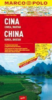
Le carte con scala 1:4.000.000 regalano al viaggiatore un'ampia visione su un intero continente o porzioni di esso. In un formato comodo e maneggevole tutte le informazioni che riguardano il territorio dal punto di vista geografico, stradale e paesaggistico. Sono segnalate località di interesse turistico, punti e strade panoramiche, i parchi e le aree naturali protette. Un ricco fascicolo interno con l'elenco di tutte le località indicate sulla carta, informazioni e numeri utili, tabella delle distanze chilometriche e tempi di percorrenza. Sono garantite leggibilità, completezza di informazione e praticità: sticker removibili consentono infatti di evidenziare comodamente le tappe del proprio viaggio.
 
lingua: Ita/Ingl/Fra/Ted
 
confezione : copertina plastificata, piega a portafoglio
 
 
add to wish list
€ 8.08
instead of € 8.50
quantity
- 1 +
ship to :: Italia
Corriere espresso € 5.50
availability
Out of stock