


contact us

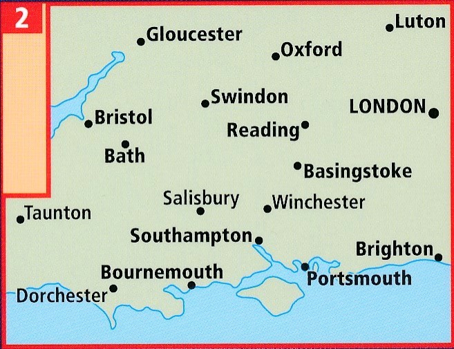
La mappa stradale AA dell'Inghilterra centro-meridionale è una mappa pratica, sottile e pieghevole realizzata dagli esperti dell'AA. Racchiusa in una custodia resistente e resistente alle intemperie, la mappa è realizzata in scala 1:200.000 (2 km a 1 cm), combinando un design chiaro, una scala di facile lettura e maggiori dettagli stradali per garantire che non si perda mai la strada.
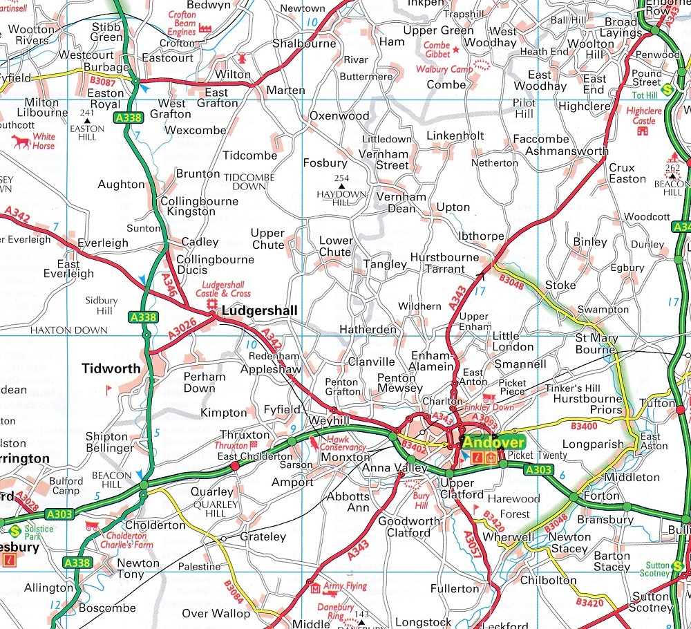
Sono inclusi anche caselli autostradali, aree di servizio, numeri civici, autostrade, strade a doppia carreggiata e strade locali ampie e strette, parchi nazionali e altri luoghi di interesse.
• Posizioni degli autovelox completamente aggiornate, oltre a quelli con i limiti di velocità
• Indice dei nomi delle località chiaro
• 8 mappe di città e comuni
• Aree di sosta per roulotte e campeggi sono individuate sulla mappa
• Parchi nazionali e luoghi di interesse sono evidenziati
• Siti del National Trust, dell'English Heritage, del patrimonio scozzese e gallese mostrati
La mappa stradale dell'Inghilterra centro-meridionale fa parte di una serie di mappe stradali della Gran Bretagna realizzate da esperti dell'AA.
Britain's clearest mapping from the experts at the AA, in a handy foldable road map covering the Central Southern England. Fully updated, the map combines clear design and an easy-to-read scale of 3 miles to 1 inch, with more road detail to ensure you never lose your way while navigating Britain's roads. The map includes information on toll points, service areas, road numbers, motorways, dual carriageways and wide and narrow local roads. National parks and places of interest are also highlighted.