


contact us
Mauritius with Rodrigues at 1:90,000 from ITBM showing the topography of the two islands by altitude colouring. The maps and the accompanying street plans of Port Louis and Curepipe highlight tourist accommodation and various places of interest.
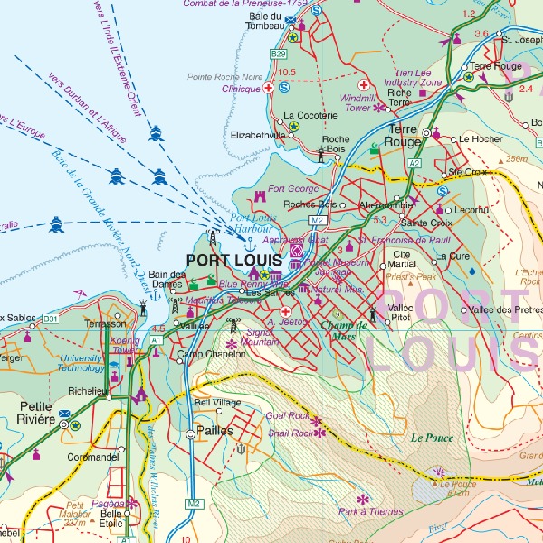
The two islands are shown on separate panels, presenting their topography by altitude colouring. In the surrounding coastal waters coral reefs are marked. National parks and other protected areas are highlighted and symbols provide further tourist information including selected accommodation, beaches, surfing and diving sites, etc. Road network indicates unmaintained tracks and shows locations of petrol stations. Latitude and longitude lines are drawn at intervals of 5’. Both islands have an index of localities. Map legend is in French and English.
Large, clear street plans of Port Louis and Curepipe also indicate various sights and accommodation, as well as facilities such as banks, bus terminals, etc.