


contact us
Pacific countries of Fiji and Tonga on a double-sided map from ITMB which presents Fiji divided between the two sides on the map, whilst the islands of Tonga are shown on separate panels at scales according to their size. An overview panel of that section of the Pacific shows the two groups together at 1:4,500,000, clearly indicating coverage on each side of the map.
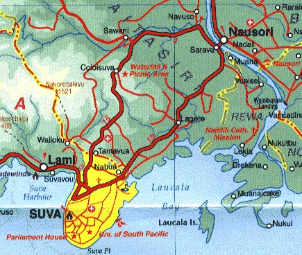
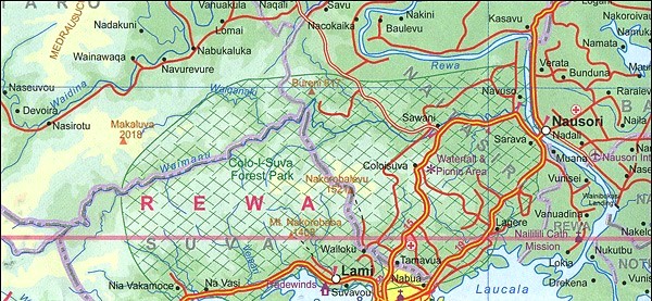
On one side the two main islands of Fiji, Viti Levu and Vanua Levu, with the nearby islands are presented at 1:380,000. Also shown here are panels with the outlaying islands of Rotuma (1:140,000), Vatulele / Beqa / Kadavu (1:550,000), and Thikombia (1:550,000), plus a street plan of Suva.
The western part of Fiji, the Lau group of islands, is on the reverse, also at 1:550,000, with its southernmost islands (including Vatoa Island where Captain Cook landed in 1774) shown as an inset at a smaller scale of 1:1,200,000. Coverage of Fiji has an index and the maps have latitude and longitude lines at 30’ intervals.
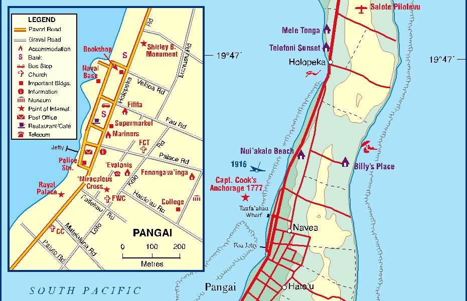
Adjoining coverage of western Fiji are panels showing the islands of Tonga: Tongatapu at 1:110,000 with a street plan of Nuku’alofa; the Ha’apai Group (Ha’ano, Foa, Lifuka, Uoleva and ‘Uiha) at 1:50,000 with a small plan of Pangai; Vava’u and nearby islands at 1:70,000 with a plan of Naiafu; Niuatoputapu at 1:50,000; Niuafo’Ou at 1:75,000; plus Kano and Tofua at 1:130,000. Coverage of Tonga has no index of localities; latitude and longitude are indicated by margin ticks at varying intervals.
Maps of the islands present topography by altitude colouring, with markings for swamps and mangrove area. Road network includes selected local tracks. Access by air is also indicates and between the main islands of Fiji ferry connections. Various places of interest are highlighted, including beaches, diving and snorkelling sites, etc. Street plans indicate various tourist facilities: accommodation, banks, supermarkets, etc.