


contact us

Canary Islands at 1:130,000 on a double-sided map from ITMB. Each island is presented on a separate panel at the same scale and with an index. Bold altitude colouring shows the islands’ topography, with national parks prominently highlighted. Road network includes selected local roads and tracks. Ferry connections between the islands are marked. Symbols indicate various places of interest, included beaches, surfing and diving sites, etc. Latitude and longitude lines are drawn at 10’ intervals.
The map includes insets with street plans indicating a few facilities and places of interest:
- Tenerife: Santa Cruz de Tenerife, plus Puerto de la Cruz (wrongly annotated as on La Palma)
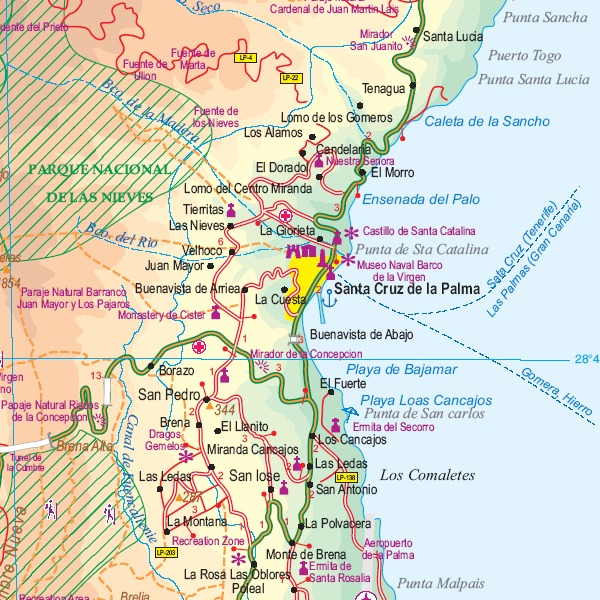
- La Palma: Santa Cruz de la Palma, Los Llanos de Aridane, Los Cancajos and Puerto Naos
- Gran Canaria: Las Palmas de la Gran Canaria
- Lanzarote: Arecife
-Fuerteventura: Ruerto del RosarioCorralejo and Morro Jable