en
wishlist
login
mail

contact us

Cartography

Hiking maps, maps and atlases, cartography around the world. Maps of the trails, cartography for cyclotourism and mountain biking

Mountain

Alpine guides, hiking guides, technical manuals for summer and winter mountaineering. Mountain literature and filmography

Sea

Nautical manuals, nautical cartography, books and literature for sailboat and motor

Travels

Travel guides and travel literature for Italy, Europe and the rest of the world

Military

Collection of the best publications (books and DVDs) on the mountain war on the Alps and the rest of Italy and Europe
back
Africa equatoriale
ITMB | Carte stradali | Vancouver | 07/2014 | 10 x 25 | 1:3.400.000

Africa equatoriale

1:3.400.000

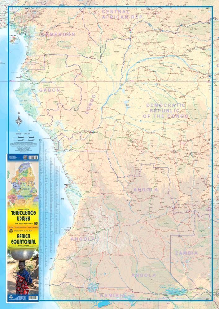
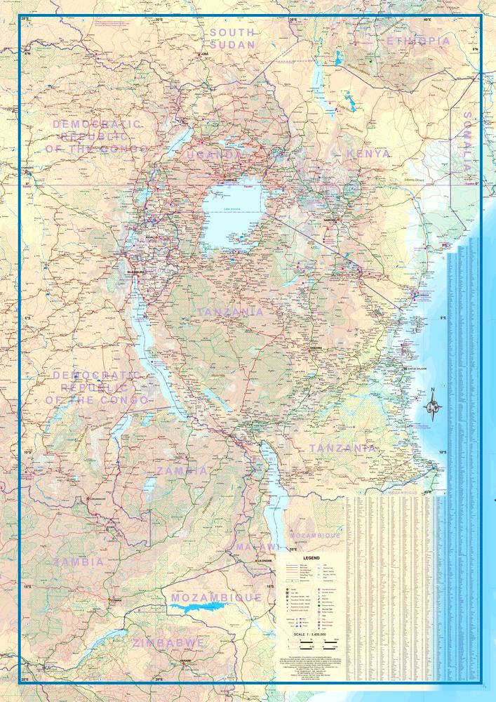
This is the third regional map covering the African continent and covers the portion just south of Nigeria/Cameroun that, essentially, straddles the equator. ITMB has divided the southern half of the African continent into three double-sided sheets at a better scale. This is the first one, covering Africa as far south as Zambia, with a bit of Zimbabwe. As with all of our regional African maps, this one focuses on road conditions, distances, urban areas, facilities, parks and attractions.

Legend includes: roads by classification, motorway, main road, secondary road, tertiary road, lake, seasonal lake, dry lake, river, museum, ferry, hotels, world heritage, waterfall and more.

add to wish list
€ 13.50
quantity
- 1 +
ship to :: Italia
Corriere espresso € 6.00
availability
usually shipped within 10/30 days
add to cart