en
wishlist
login
mail

contact us

Cartography

Hiking maps, maps and atlases, cartography around the world. Maps of the trails, cartography for cyclotourism and mountain biking

Mountain

Alpine guides, hiking guides, technical manuals for summer and winter mountaineering. Mountain literature and filmography

Sea

Nautical manuals, nautical cartography, books and literature for sailboat and motor

Travels

Travel guides and travel literature for Italy, Europe and the rest of the world

Military

Collection of the best publications (books and DVDs) on the mountain war on the Alps and the rest of Italy and Europe
back
G32 Eastern Sporades, Dodecanese & the Coast of Turkey
Imray | U.K. | 2018 | impermeabile | A4 in custodia plastificata | 1:200.000

G32 Eastern Sporades, Dodecanese & the Coast of Turkey

WGS 84

Plans included:
Kusadasi (Turkey) (1:17 500)
Stenón Sámou (1:85 000)
Póros Fóurnon (1:25 000)
Órmos Pátmou (Nísos Pátmos) (1:50 000)
Órmos Parthéni (Nísos Léros) (1:50 000)
Yalikavak Limani (Turkey) (1:75 000)

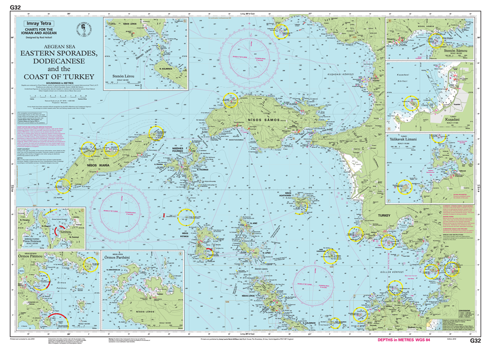
For this 2014 edition the chart has been fully updated throughout and the latest known depths applied. Harbour developments are shown at Kusadasi. The plan of Áyros Kírikos has been replaced with a brand new plan of Póros Foúron, designed to show passage through Nisídhes Foúrnoi.

PDF aggiornamento


index
add to wish list
€ 35.94
quantity
- 1 +
ship to :: Italia
Corriere espresso € 6.00
availability
Out of stock
notify when available