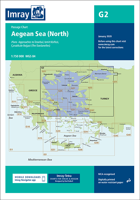
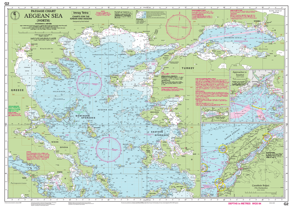
en
wishlist
login
mail

contact us

Cartography

Hiking maps, maps and atlases, cartography around the world. Maps of the trails, cartography for cyclotourism and mountain biking

Mountain

Alpine guides, hiking guides, technical manuals for summer and winter mountaineering. Mountain literature and filmography

Sea

Nautical manuals, nautical cartography, books and literature for sailboat and motor

Travels

Travel guides and travel literature for Italy, Europe and the rest of the world

Military

Collection of the best publications (books and DVDs) on the mountain war on the Alps and the rest of Italy and Europe
back
G2 Aegean Sea (North) - Passage Chart
Imray | U.K. | 2020 | Impermeabile | A4 in custodia plastificata | 1:750.000

G2 Aegean Sea (North) - Passage Chart

WGS 84

Passage Chart

Plans included:

Approaches to Ístanbul (1:150,000)
Izmit Körfezi (1:500,000)
Çanakkale Bogazi (The Dardanelles) (1:300,000)

On this edition the chart specification has been improved to show coloured light flashes. Completed harbour works are included on the plan of the approaches to Istanbul. There has been general updating throughout.

index
add to wish list
€ 35.94
quantity
- 1 +
ship to :: Italia
Corriere espresso € 6.00
availability
Out of stock
notify when available