en
wishlist
login
mail

contact us

Cartography

Hiking maps, maps and atlases, cartography around the world. Maps of the trails, cartography for cyclotourism and mountain biking

Mountain

Alpine guides, hiking guides, technical manuals for summer and winter mountaineering. Mountain literature and filmography

Sea

Nautical manuals, nautical cartography, books and literature for sailboat and motor

Travels

Travel guides and travel literature for Italy, Europe and the rest of the world

Military

Collection of the best publications (books and DVDs) on the mountain war on the Alps and the rest of Italy and Europe
back
Chelmos - Vouraikos (8.2)
Anavasi | Carte escursionistiche | Grecia | 02/2020 | 13 x 23 | 1:50.000

Chelmos - Vouraikos (8.2)

1:50.000

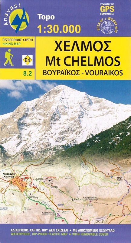
The hiking map of Chelmos covers the area in Northern Peloponnese from Lake Tsivlos and the forests of Zarouchla to the gorge of the Styx; from the source of the river Aroanios, ancient Klitoria and the Cave of the Lakes to the remains of ancient Lousii; from the fertile farmlands of the Kerinitis valley to the panoramic view of Mt Klokos - all around the visitor unfolds a landscape rich in its beauty and its history. 

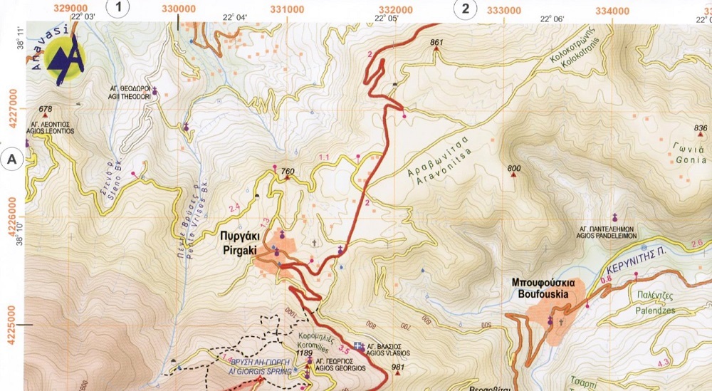
By mistake the road connecting Ano Potamia to Ano Diakopto, appears as asphalt road on the map; in reality it is a dirt road in poor condition.

GPS compatibile

index
add to wish list
€ 11.00
quantity
- 1 +
ship to :: Italia
Corriere espresso € 6.00
availability
temporarily unavailable
notify when available