


contact us

On one side Sikkim is shown on a detailed map with altitude colouring plus spot heights presenting its topography. Road network differentiates between paved and unsurfaced roads and includes selected local tracks. Wildlife sanctuaries are highlighted. Symbols indicate locations with tourist accommodation, monasteries and temples etc. Also provided is a street plan of Gangtok annotated with accommodation, facilities and sights.
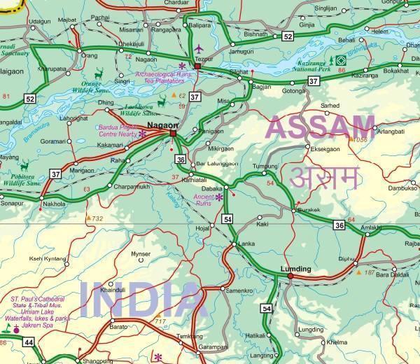
On the reverse is an indexed map covering north-eastern India with eastern Nepal. With altitude colouring to show the topography of Assam, Arunchal Pradesh and the other states. The map shows the region’s road and rail networks, local airports, places of interest etc. Also provided on this side is a street plan of central Kolkata (Calcutta), annotated with sights and facilities, plus an enlargement showing road and rail networks in the city’s environs.