Cina
1:3.800.000
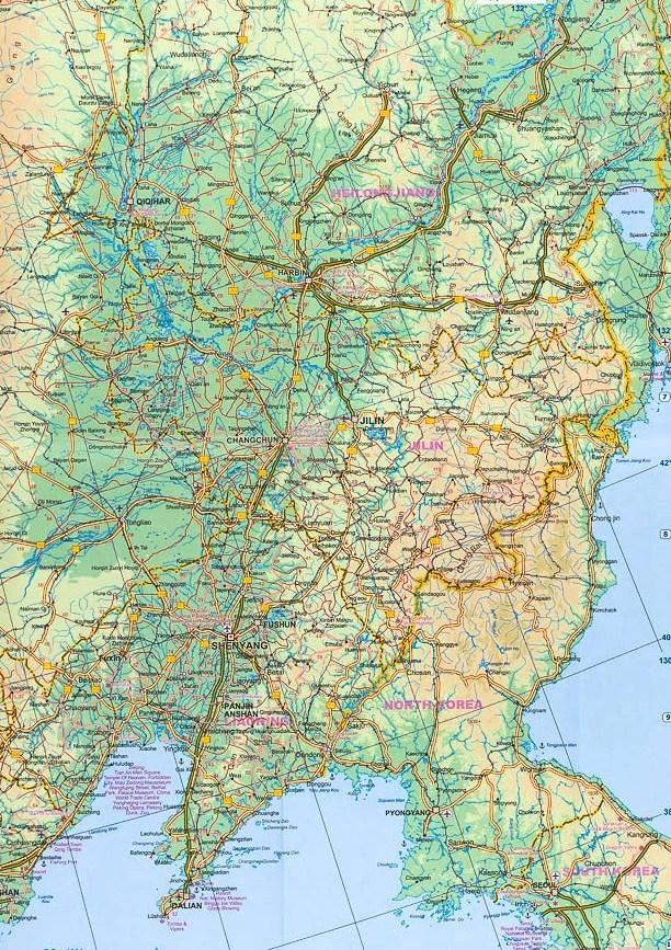
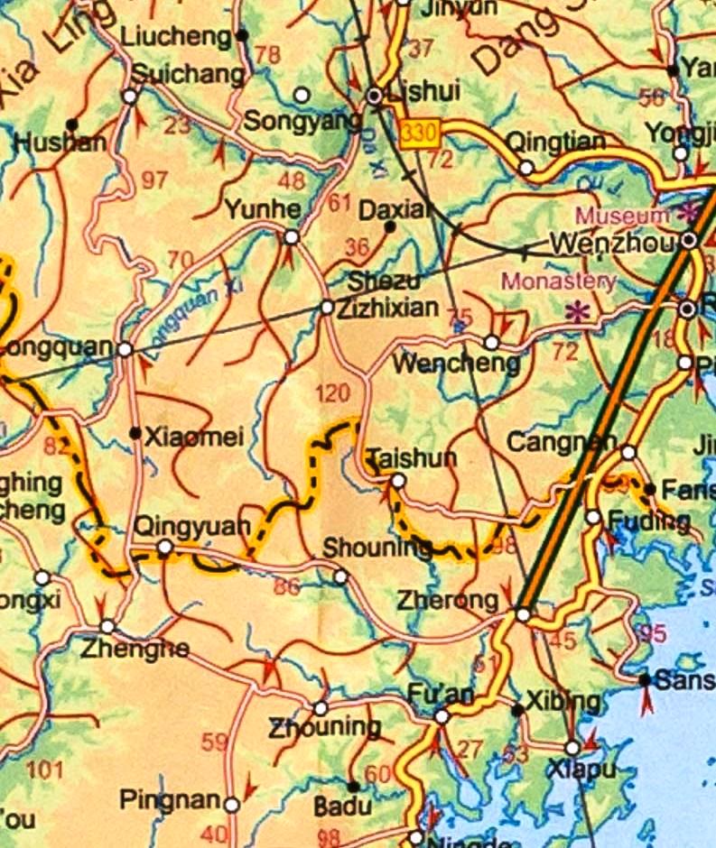
Large double-sided map of China including Taiwan, with Hai Nam in an inset. Elevation tinting in pastel shades shows the general relief, and selected mountain peak altitudes are marked. The map shows China's provincial boundaries, and symbols for cities classify them according to population size. Road detail distinguishes, expressways, state highways and provincial highways and includes some lower order connecting routes. Intermediate driving distances are indicated on many routes. Main railways and the Great Wall are included and symbols depict ports, airports, passes, locations of interest, ruins, nature reserves and forest parks. Other detail includes swamps, sand expanses, glaciers, salt water lakes, salt pans and the Great Wall. Latitude and longitude lines are drawn at 2 degree intervals. Coverage divides the country into east a west sections with a generous overlap. All text is in roman script only.The map includes an index of place names. A plan of central Beijing is provided in an inset. This is not indexed but indicates many landmarks, sites of interest and


