en
wishlist
login
mail

contact us

Cartography

Hiking maps, maps and atlases, cartography around the world. Maps of the trails, cartography for cyclotourism and mountain biking

Mountain

Alpine guides, hiking guides, technical manuals for summer and winter mountaineering. Mountain literature and filmography

Sea

Nautical manuals, nautical cartography, books and literature for sailboat and motor

Travels

Travel guides and travel literature for Italy, Europe and the rest of the world

Military

Collection of the best publications (books and DVDs) on the mountain war on the Alps and the rest of Italy and Europe
back
Reykjanes (blad 18)
Idnu Ferdakort | 1:100.000 | Reykjavik | 01/1987 | 11 x 20 - 56 x 50 | 1:100.000

Reykjanes (blad 18)

Carta topografica

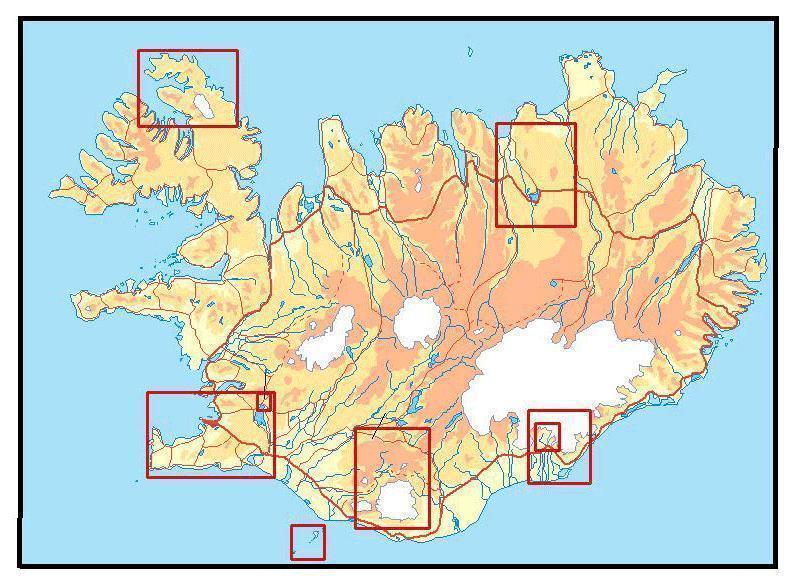
Topography shown by contours
Detailded informations on geology and vegetation
Road and tracks network
Legend in islandic and english

I fogli dell'Atlante furono originariamente realizzati da topografi danesi durante i primi quattro decenni del XX secolo. Gli 87 fogli sono considerati tra le mappe più belle dell'Islanda. Le mappe dell'Atlante mostrano la superficie terrestre con notevole dettaglio, con intervalli di 20 metri tra le curve di livello, strade, sentieri e numerosi toponimi. La realizzazione di queste mappe fu una grande conquista per l'epoca e rappresenta una parte importante del patrimonio culturale islandese.


index
add to wish list
€ 22.00
quantity
- 1 +
ship to :: Italia
Corriere espresso € 6.00
availability
usually shipped within 10/30 days
add to cart