en
wishlist
login
mail

contact us

Cartography

Hiking maps, maps and atlases, cartography around the world. Maps of the trails, cartography for cyclotourism and mountain biking

Mountain

Alpine guides, hiking guides, technical manuals for summer and winter mountaineering. Mountain literature and filmography

Sea

Nautical manuals, nautical cartography, books and literature for sailboat and motor

Travels

Travel guides and travel literature for Italy, Europe and the rest of the world

Military

Collection of the best publications (books and DVDs) on the mountain war on the Alps and the rest of Italy and Europe
back
Westman Islands
Ferdakort | Special map | Reykjavik | 01/1995 | 13 x 22 | 1:50.000

Westman Islands

Special Maps

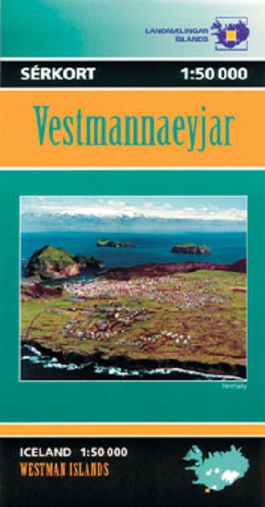
Vestmannaeyjaer/Westman Islands at 1:50,000 in a series of special detailed hiking and touring maps, based on the Icelandic topographic survey, covering the most visited parts of the country. The map provides topographic coverage of the islands, with a street plan of the built-up area on Heimaey. On the reverse, an aerial photo shows Haimaey Island at 1:10,000. The map has a grid showing latitude and longitude in steps of 1' and 2' respectively. Map legend is in Icelandic only.


A map with an overview of the Westman Islands, and also a more precise map of the town.

add to wish list
€ 20.00
quantity
- 1 +
ship to :: Italia
Corriere espresso € 6.00
availability
usually shipped within 15/30 days
add to cart