


contact us
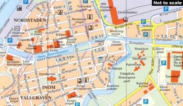
Gothenburg/Göteborg on an indexed street plan from Norstedts Kartförlaget showing the city’s tram network, ferry connections, car parks, etc. Main public buildings are highlighted and named, and streets are shown with selected house numbers for easier identification of addresses. Tram routes are shown with line numbers and ferry routes are marked. Map legend includes English.
On the reverse is a street index, plus lists of main places of interest and museums, youth hostels, boat trips, etc.
The publishers, Norstedts Kartförlaget, is the now privatized section of Sweden’s national survey organization, Lantmäteriet.