


Mappa stradale dell'Asia centrale
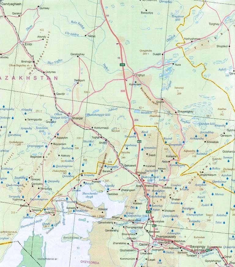
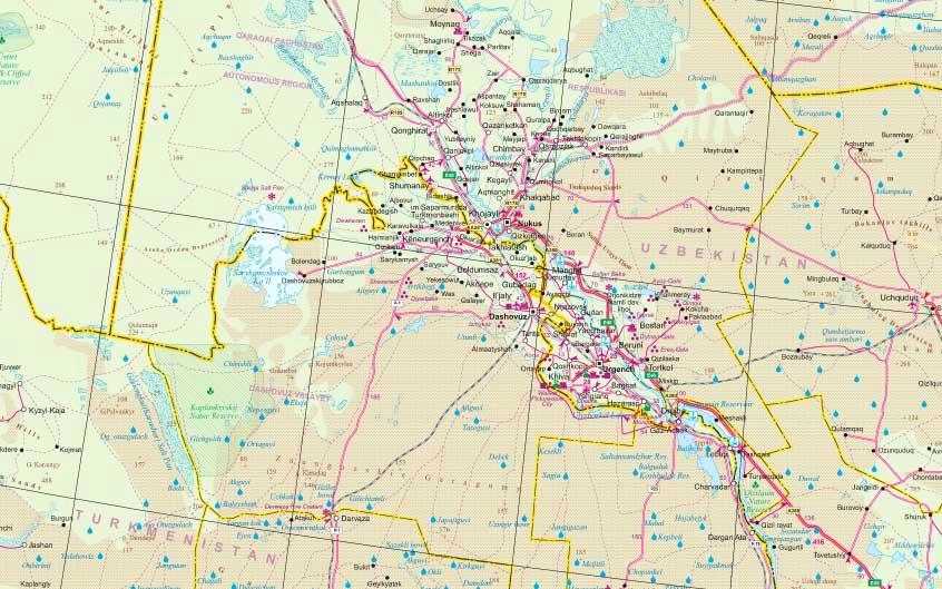
La mappa presenta una piccola sovrapposizione tra i due lati e copre tutto l'Uzbekistan, il Tagikistan e il Kirghizistan, oltre al Kazakistan. Mancano solo piccole aree lungo il confine settentrionale con la Russia e il confine nord-occidentale con la Cina, e anche il Turkmenistan, dove non è inclusa la parte sud-occidentale del paese con Ashgabat.
La topografia della regione è illustrata da colori vivaci con altezze puntiformi e nomi di cime, catene montuose ecc., oltre a grafici per deserti, paludi, saline e ghiacciai. Sono evidenziati parchi nazionali e altre aree protette, nonché numerosi pozzi d'acqua. La mappa mostra la rete stradale, inclusi alcuni percorsi stagionali selezionati e il percorso della Via della Seta, le ferrovie e gli aeroporti locali. I simboli indicano la posizione di vari luoghi di interesse, inclusi i siti Patrimonio dell'Umanità della zona.