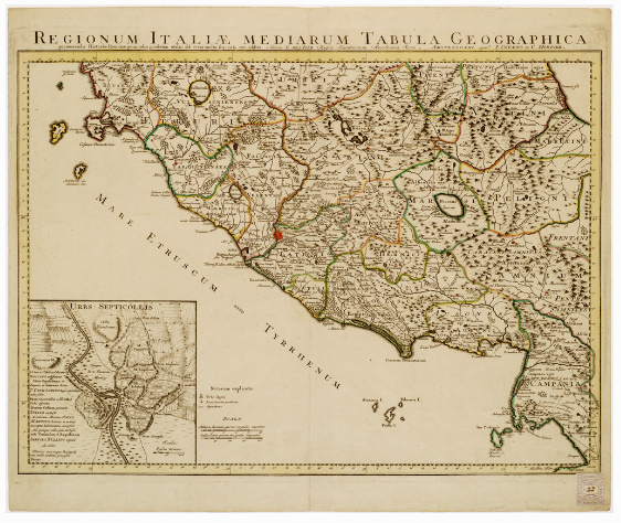
B10 - REGIONUM ITALIAE MEDIARUM TABULA GEOGRAPHICA...
...PERNOSCENDIS HISTORIAE ROMANAE PRIMORDIIS PRAESERTIM UTILIS SED ET CUI MULTA SEQUIORIS AEVI ADDITA. AUTORE G. DELL'ISLE. REGIA SCIENTIARUM ACADEMIA SOCIO. AMSTELODAMI, APUD I COVENS ET C. MORTIER. Incisione su rame in un sol foglio. Comprende l'Italia centrale entro i limiti: nord, Spoletium; sud, Pompeii. Orografia prospettica a monticelli. Sono tracciate le vie romane coi loro nomi. Sono distinte le selve e le zone paludose; sono indicati gli acquedotti. I principali abitati sono rappresentati schematicamente in prospettiva. La toponomastica è in latino. Le divisioni territoriali sono a colori. In basso a sinistra trovasi una cartina di Roma ("Urbis Septicollis"), con note, e scala grafica in passi romani. Le longitudini sono riferite all'isola del Ferro. Le scale grafiche sono calcolate in miglia romane e in stadia di Grecia.


