


contattaci

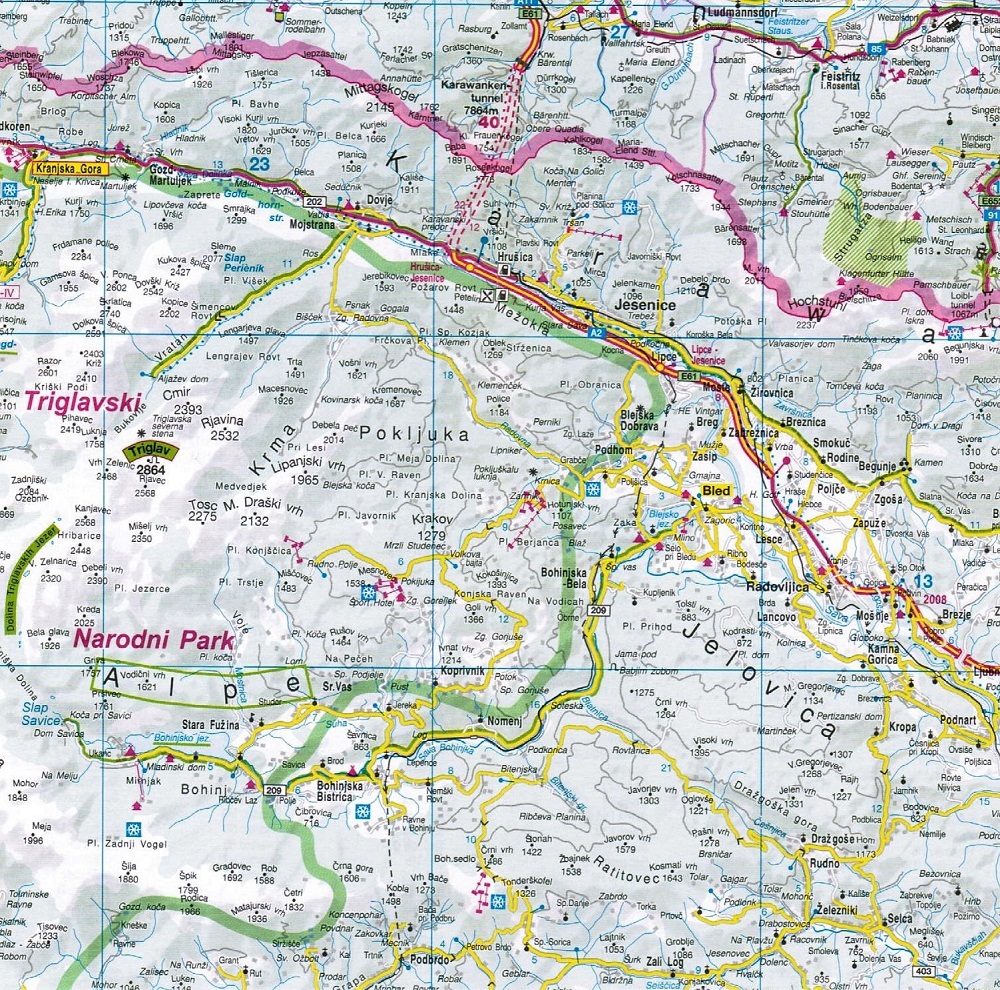
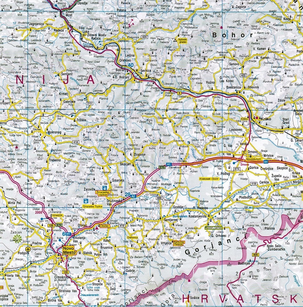
Slovenia at 1:200,000 on a large indexed map with an inset extending the coverage to include the whole of Istria. The map also provides good coverage of Carinthian Alps and south eastern Austria, plus north-eastern Italy to Udine.
Road network includes local secondary roads and selected tracks and indicates motorway services, toll roads and stations, seasonal closures, roads closed to or not recommended for caravans, roads closed to all motorized traffic, etc. Scenic routes are highlighted. The map also shows the rail network and local airports.
Picturesque towns and villages are highlighted, with symbols marking other places of interest, beautiful landscape and viewpoints, various types of accommodation including campsites and youth hostels, beaches, sport and recreational facilities, etc. Topography is shown by relief shading with spot heights and national parks or protected areas are prominently marked. The map has no geographical coordinates. The index is on the reverse of the map. Map legend includes English.